Landkarten
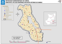
Provinz Nordkivu: Lagekarte: Landkarte zu Binnenvertriebenen in Bambu
Republique Democratique du Congo; Nord-Kivu: Site des Personnes Deplacées Internes de Bambu (Landkarte oder Infografik, Französisch)
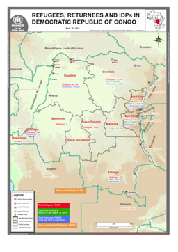
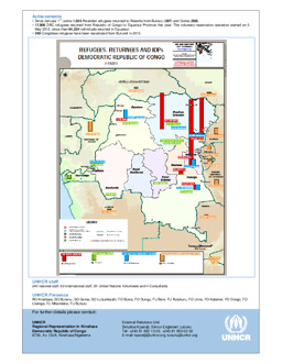
Lagekarte: Landkarte zu Vertreibung (Verteilung von Flüchtlingen; Verteilung von Rückkehrer·innen; Verteilung von Binnenvertriebenen)
Refugees, Returnees and IDPs in Democratic Republic of Congo; May 31, 2014 (Landkarte oder Infografik, Englisch)
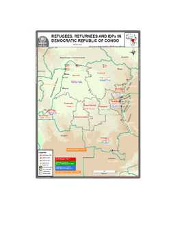
Lagekarte: Landkarte zu Vertreibung (Verteilung von Flüchtlingen; Verteilung von Rückkehrer·innen; Verteilung von Binnenvertriebenen) (mit Stand von 30. April 2014)
Refugees, Returnees and IDPs in Democratic Republic of Congo; April 30, 2014 (Landkarte oder Infografik, Englisch)
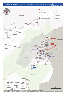
Gebiet Beni: Lagekarte: Landkarte zur humanitären Lage in Kamango (mit Stand von 19. Juli 2013)
Territoire de Beni: Situation humanitaire dans la Zone de Kamango (Landkarte oder Infografik, Französisch)
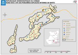
Provinz Nordkivu: Lagekarte: Landkarte zu Binnenvertriebenen in Bihito
Republique Democratique du Congo; Nord-Kivu: Site des Personnes Deplacées Internes de Bihito (Landkarte oder Infografik, Französisch)
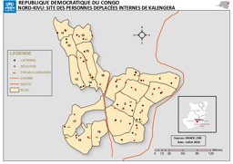
Provinz Nordkivu: Lagekarte: Landkarte zu Binnenvertriebenen in Kalengera
Republique Democratique du Congo; Nord-Kivu: Site des Personnes Deplacées Internes de Kalengera (Landkarte oder Infografik, Französisch)
Lagekarte: Landkarte zu Vertreibung (Verteilung von Flüchtlingen; Verteilung von Rückkehrer·innen; Verteilung von Binnenvertriebenen) (mit Stand von 31. März 2013)
Refugees, Returnees and IDPs; Democratic Republic of the Congo; 31/03/2013 (Landkarte oder Infografik, Englisch)
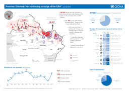
Infografik zu Vertreibung, die durch Aktivitäten der Lord's Resistance Army in der Demokratischen Republik Kongo, der Zentralafrikanischen Republik und im Südsudan verursacht wird (mit Stand von Jänner 2013)
Democratic Republic of Congo: Province Orientale: the continuing scourge of the LRA - January 2013 (Landkarte oder Infografik, Englisch)
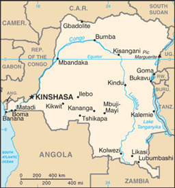
Kleine Landkarte mit wichtigen Städten
Congo, Democratic Republic (former Zaire) (Small Map) 2013 (Landkarte oder Infografik, Englisch)
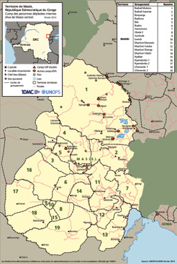
Gebiet Masisi: Lagekarte: Landkarte zur Verteilung von Lagern für Binnenvertriebene (mit Stand von Februar 2012)
Territoire de Masisi, camp des personnes déplacées internes (Axe de Masisi centre), Internal Displacement Monitoring Centre (IDMC) (February 2012) (Landkarte oder Infografik, Französisch)

Gefundene Dokumente: 552
