Maps
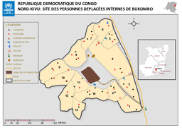
Nord-Kivu province: Situation map on IDPs in Bukombo
Republique Democratique du Congo; Nord-Kivu: Site des Personnes Deplacées Internes de Bukombo (Map or infographic, French)
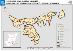
Nord-Kivu province: Situation map on IDPs in Kalinga
Republique Democratique du Congo; Nord-Kivu: Site des Personnes Deplacées Internes de Kalinga (Map or infographic, French)
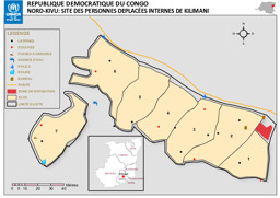
Nord-Kivu province: Situation map on IDPs in Kilimani
Republique Democratique du Congo; Nord-Kivu: Site des Personnes Deplacées Internes de Kilimani (Map or infographic, French)
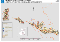
Nord-Kivu province: Situation map on IDPs in Mpati
Republique Democratique du Congo; Nord-Kivu: Site des Personnes Deplacées Internes de Mpati (Map or infographic, French)
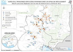
Nord-Kivu province: Situation map on locations of IDPs (as of 25 February 2015)
Nord-Kivu; Personnes déplacées internes dans les sites de déplacement; 203,551 personnes déplacées dans les sites de déplacement au 25 Février 2015 (Map or infographic, French)
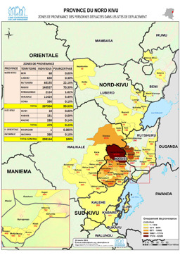
Nord-Kivu province: Situation map on the distribution of displaced people (as of 25 January 2015)
Province du Nord Kivu; Zonas de Provenance des Personnes Deplacees dans les Sites de Deplacement (Map or infographic, French)
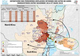
Goma region: Situation map on intended destinations of IDPs registered between November 2014 and March 2015
Intentions des personnes deplacees internes des sites de Goma enregisterees entre novembre 2014 et mars 2015; 25 March 2015 (Map or infographic, French)
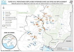
Nord-Kivu province: Situation map on locations of IDPs (as of 25 December 2014)
Nord-Kivu; Personnes déplacées internes dans les sites de déplacement; 208,636 personnen déplacées dans les sites de déplacement au 25 Décembre 2014 (Map or infographic, French)
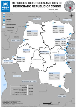
Situation map on displacement (distribution of refugees; distribution of returnees; distribution of IDPs) (as of 31 October 2014)
Refugees, Returnees and IDPs in Democratic Republic of Congo; October 31, 2014 (Map or infographic, English)
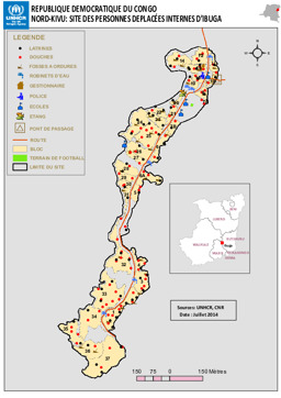
Nord-Kivu province: Situation map on IDPs in Ibuga
Republique Democratique du Congo; Nord-Kivu: Site des Personnes Deplacées Internes D'Ibuga (Map or infographic, French)
Documents found: 552
