Maps
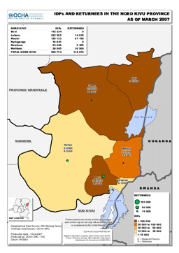
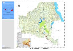
Nord Kivu province: Situation map on the distribution of IDPs and returnees (as of March 2007)
IDPs and Returnees in the Nord Kivu Provinces (as of March 2007) (Map or infographic, English)
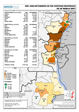
Eastern provinces: Situation map of IDPs and returnees (as of March 2007)
IDPs and Returnees in the Eastern Provinces (as of March 2007) (Map or infographic, English)
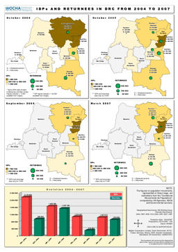
Situation map on the distribution of IDPs and returnees (covering 2004 to 2007)
IDPs and Returnees in DRC from 2004 to 2007 (Map or infographic, English)
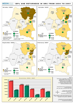
Situation map on the distribution of IDPs and returnees (covering 2004 to 2007)
Democratic Republic of Congo: IDPs and Returnees from 2004 to 2007 (Map or infographic, English)
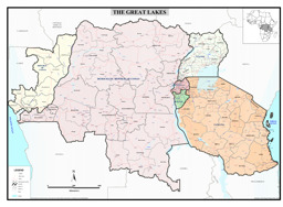
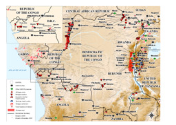
Political map of the Great Lakes region with administrative divisions
Reference map of the Great Lakes region (Map or infographic, English)
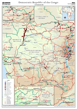
Situation map on UNHCR in the country
UNHCR in the Democratic Republic of the Congo (as of 1 Jun 2006) (Map or infographic, English)
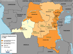
Situation map on internal displacement
Internal Displacement in DRC (IDMC) (Map or infographic, English)
Political map
Atlas map (as of September 2006) (Map or infographic, English)

Reference maps of Democratic Republic of the Congo - Provinces
Reference maps of Democratic Republic of the Congo - Provinces (Map or infographic, English)
Katanga: Thematic map on infrastructure (roads; railway; ports; airports), with main cities
Carte du Katanga (Map or infographic, French)
/7DCF0D3A9F7AFE53C125721800367576/$file/IDP_DRC_31oct06.gif)
Documents found: 552
