Maps
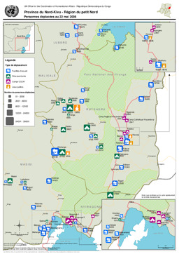
Nord Kivu: Situation map of displaced people (as of 22 May 2008)
Province du Nord-Kivu - Personnes déplacées au 22 mai 2008 (Map or infographic, English)
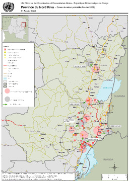
Nord Kivu province: Situation map of areas of probable return of IDPs (as of February 2008)
Province du Nord Kivu - Zones de retour probable (Février 2008) (Map or infographic, English)
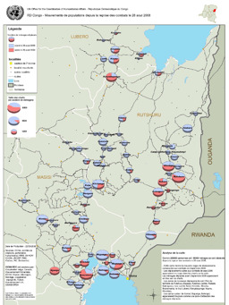
Situation map of movement of populations since beginning of fighting in August 2008
Mouvements de populations depuis la reprise des combats le 28 août 2008 (Map or infographic, French)
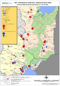
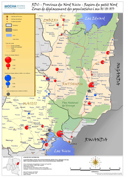
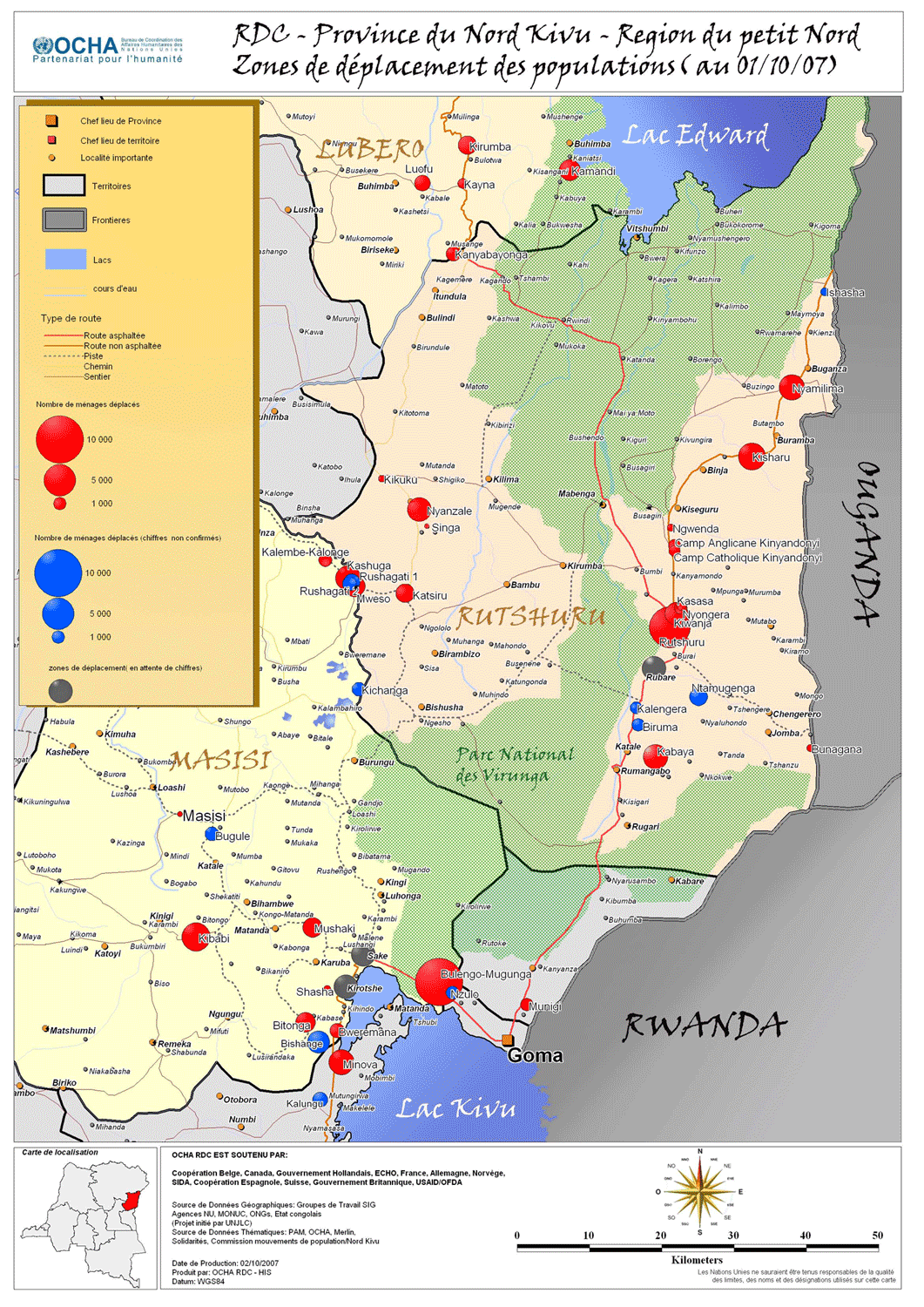
Nord Kivu province: Situation map of zones of displacement (as of January 2008)
Province du Nord Kivu - Région du Petit Nord - Zones de déplacement des populations, (January 2008) (Map or infographic, English)
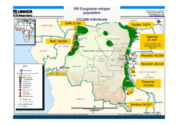
Situation map on the distribution of Congolese refugees among neighbouring countries (as of 12 January 2007)
DR Congolese Refugee Population (as of 3 Oct 2007) (Map or infographic, English)
Nord Kivu: Situation map of zones of displacements (as of 1 October 2007)
Province North Kivu - Zones of displacements (as of 1 October 2007) (Map or infographic, English)
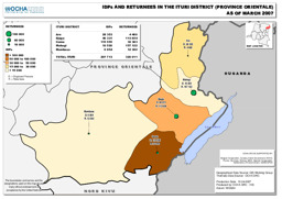
Ituri district: Situation map on the distribution of IDPs and returnees (as of March 2007)
Democratic Republic of the Congo: IDPs and Returnees in the Ituri District - Province Orientale (as of March 2007) (Map or infographic, English)
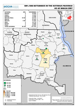
Katanga province: Situation map on the distribution of IDPs and returnees (as of March 2007)
Democratic Republic of the Congo: IDPs and Returnees in the Katanga Province (as of March 2007) (Map or infographic, English)
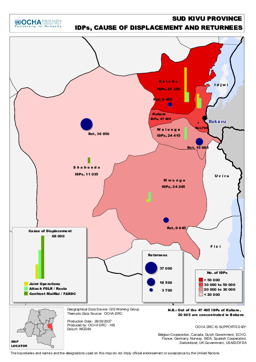
Sud Kivu province: Situation map on the distribution of IDPs as well as the cause of displacement and returnees (as of March 2007)
Democratic Republic of the Congo: Sud Kivu Province - IDPs, Cause of Displacement and Returnees (as of March 2007) (Map or infographic, English)
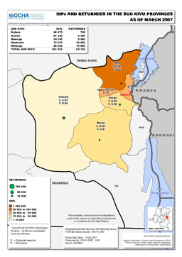
Sud Kivu province: Situation map on the distribution of IDPs and returnees (as of March 2007)
Democratic Republic of the Congo: IDPs and Returnees in the Sud Kivu Provinces (as of March 2007) (Map or infographic, English)
Documents found: 552
