Maps
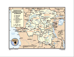
Thematic map on infrastructure (roads; railway; airports) with administrative divisions (province level) and main cities
Democratic Republic of the Congo (Map or infographic, English)
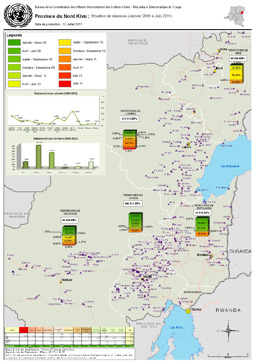
Nord Kivu province: Situation map on the distribution of displaced persons (covering January 2009 to June 2011)
Province du Nord Kivu: Situation de déplacés (Janvier 2009 à Juin 2011), UN Office for the Coordination of Humanitarian Affairs (UN OCHA) (July 2011) (Map or infographic, French)
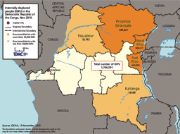
Situation map on the distribution of IDPs (as of 15 November 2010)
Internally displaced people in the DRC, Internal Displacement Monitoring Centre (IDMC) (November 2010) (Map or infographic, English)
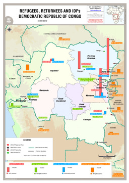
Situation map on the distribution of refugees, returnees and IDPs (as of 31 August 2010)
Refugees, Returnees and IDPs Democratic Republic of Congo (as of 31 Aug 2010) (Map or infographic, English)
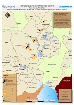
Nord Kivu province: Situation map showing displacement and camps for IDPs (covering 27 May to 15 June 2010)
République Démocratique du Congo : Province du Nord Kivu - Evolution du nombre des déplacés internes dans les camps du Nord et Sud Kivu du 27 mai au 15 juin 2010 (Map or infographic, English)
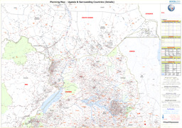
Political map (as of June 2010)
Uganda and Surrounding Countries (Details) - As of Jun 2010 (Map or infographic, English)
Situation map outlining voluntary returns, according to information gathered in camps (as of May 2010)
République Démocratique du Congo : Province du Nord Kivu - Analyse des localités de retours sur la base des attestations de retour volontaire délivrées dans les camps (au mai 2010) (Map or infographic, English)
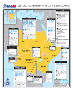
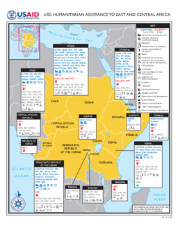
Situation map on humanitarian assistance by USAID (as of 3 May 2010)
USG Humanitarian Assistance to East and Central Africa (Map or infographic, English)
Situation map on humanitarian assistance by USAID (as of 11 January 2010)
USG Humanitarian Assistance to East and Central Africa (Map or infographic, English)
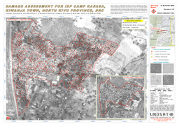
Nord Kivu province: Situation map on damage in IDP camp Kasasa, Kiwanja Town (as of November 2008)
Damage Assessment for IDP Camp Kasasa, Kiwanja Town, North Kivu Province, United Nations Operational Satelite Applications Programme (UNOSAT) (November 2008) (Map or infographic, English)
Documents found: 552
