This page gives you an overview on maps about Afghanistan collected on ecoi.net. More maps are available in our full-text search.
Ethnic groups and topography
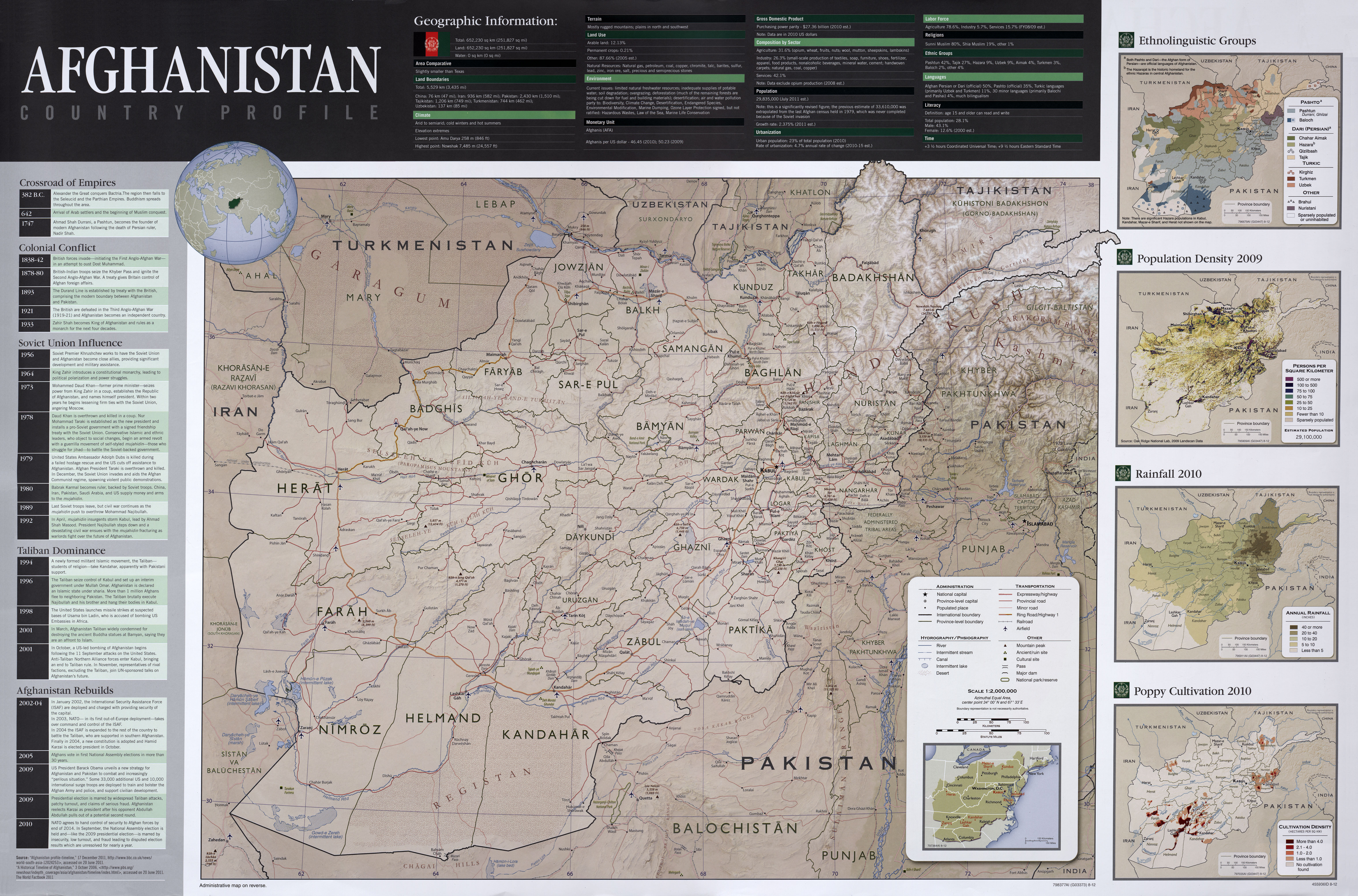
A 2012 CIA country profile contains maps on ethno-linguistic groups, population density, mountains, major roads and water bodies:
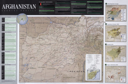
Political map, population map, topical map and situation map with administrative divisions (province level) (ethnic groups; languages; population density; rainfall; poppy cultivation)
Afghanistan (Wall Map) 2012 "Afghanistan Country Profile" (Map or infographic, English)
An atlas published by the Austrian ministries for interior and defence in 2018 contains maps on topography (p. 9), ethnic (p. 23) and religious groups (p. 25):
Political maps, population maps, thematic maps and situation maps with administrative divisions (district level) and with main cities (ethnic groups; religious groups; oil and gas; security situation)
Atlas Afghanistan (Map or infographic, English)
In the ecoi.net search, you can find more maps on:
Administrative divisons: Districts
UN OCHA published a series of reference maps on Afghanistan's districts. Please also see the following note ba Afghanistan Analysts on issues relating to the official number of Afghan districts: AAN, 16. August 2018.
Western Region: Thematic maps with administrative divisions (province level and district level) and main cities on infrastructure (traffic; health facilities; schools)
Afghanistan; Western Region; District Atlas (Map or infographic, English)
Northern Region: Thematic maps with administrative divisions (province level and district level) and main cities on infrastructure (traffic; health facilities; schools)
Afghanistan; Northern Region; District Atlas (Map or infographic, English)
Central Highland: Thematic maps with administrative divisions (province level and district level) and main cities on infrastructure (traffic; health facilities; schools)
Afghanistan; Central Highland; District Atlas (Map or infographic, English)

North Eastern Region: Thematic maps with administrative divisions (province level and district level) and main cities on infrastructure (traffic; health facilities; schools)
Afghanistan; North Eastern Region; District Atlas (Map or infographic, English)
Badakhshan province: Thematic maps with administrative divisions (province level and district level) and main cities on infrastructure (traffic; health facilities; schools)
Afghanistan; Badakhshan Province; District Atlas (Map or infographic, English)
Khost province: Thematic maps with administrative divisions (province level and district level) and main cities on infrastructure (traffic; health facilities; schools)
Afghanistan; Khost Province; District Atlas (Map or infographic, English)

Southern Region: Thematic maps with administrative divisions (province level and district level) and main cities on infrastructure (traffic; health facilities; schools)
Afghanistan; Southern Region; District Atlas (Map or infographic, English)
Southeastern Region: Thematic maps with administrative divisions (province level and district level) and main cities on infrastructure (traffic; health facilities; schools)
Afghanistan; South Eastern Region; District Atlas (Map or infographic, English)
Panjsher province: Thematic maps with administrative divisions (province level and district level) and main cities on infrastructure (traffic; health facilities; schools)
Afghanistan; Panjsher Province; District Atlas (Map or infographic, English)
Central Region: Thematic maps with administrative divisions (province level and district level) and main cities on infrastructure (traffic; health facilities; schools)
Afghanistan; Central Region; District Atlas (Map or infographic, English)

Eastern Region: Thematic maps with administrative divisions (province level and district level) and main cities on infrastructure (traffic; health facilities; schools)
Afghanistan; Eastern Region; District Atlas (Map or infographic, English)
Find more political maps in the ecoi.net search.
Cities
The Afghan government released the following publication on land use in Afghan cities, jointly with UN Habitat in 2015:
Political maps and thematic maps: Maps and data with administrative divisions (province level) on provincial capitals (see also accompanying Volume I: ID 2000664)
State of Afghan Cities 2015 - Volume II (Map or infographic, English)
Find more city maps in the ecoi.net search.
AIMS maps
The Afghanistan Information Management Services (AIMS) several years ago published comprehensive and detailed maps on Afghanistan. The collection includes background maps, for instance on vegetation and weather or geology, as well as detailed maps on the districts (at the time). Unfortunately, these maps are no longer available online from AIMS. However, the links to the AIMS maps available on ecoi.net can at least in most cases be used in the Wayback Machine of the Internet Archive to gain access to the maps there.
More maps
More maps and infographics with the option to use filters can be found in the ecoi.net search: Afghanistan maps on ecoi.net. Please note that the recognition of text in graphical documents such as maps often does not work well. This means that place names often can't be found in the full-text search, even when the name is visible on a map.

- Austrian Red Cross
- Austrian Centre for Country of Origin and Asylum Research and Documentation (ACCORD)
- Wiedner Hauptstraße 32, 1041 Wien
- T +43 1 589 00 583
- F +43 1 589 00 589
- info@ecoi.net
ecoi.net is run by the Austrian Red Cross (department ACCORD) in cooperation with Informationsverbund Asyl & Migration. ecoi.net is funded by the Asylum, Migration and Integration Fund, the Austrian Ministry of the Interior and Caritas Austria. ecoi.net is supported by ECRE & UNHCR.