Maps
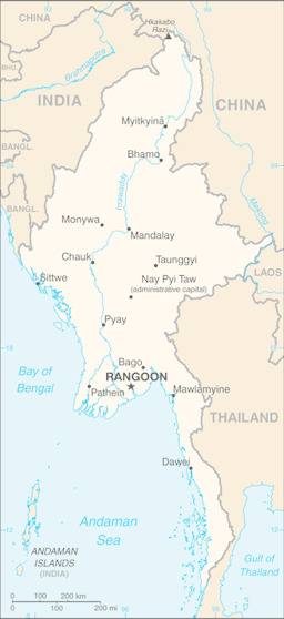
Small map with water bodies and main cities
Myanmar (Small Map) 2016 (Map or infographic, English)
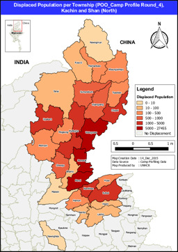
Situation map on the displaced population per township in Kachin and Shan states
Displaced Population per Township (POO_Camp Profile Round_4), Kachin and Shan (North) (Map or infographic, English)
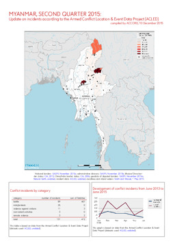
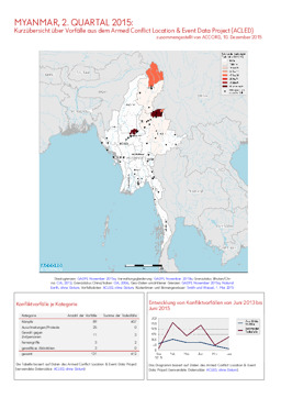
Update on conflict-related incidents according to the Armed Conflict Location & Event Data Project (covering second quarter 2015)
Myanmar, 2. Quartal 2015: Kurzübersicht über Vorfälle aus dem Armed Conflict Location & Event Data Project (ACLED) (Map or infographic, English)
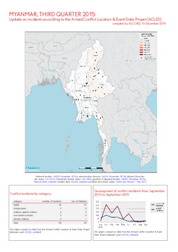
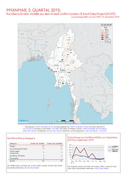
Update on conflict-related incidents according to the Armed Conflict Location & Event Data Project (covering third quarter 2015)
Myanmar, 3. Quartal 2015: Kurzübersicht über Vorfälle aus dem Armed Conflict Location & Event Data Project (ACLED) (Map or infographic, English)
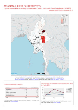
Update on conflict-related incidents according to the Armed Conflict Location & Event Data Project (covering first quarter 2015)
Myanmar, 1. Quartal 2015: Kurzübersicht über Vorfälle aus dem Armed Conflict Location & Event Data Project (ACLED) (Map or infographic, English)
Update on conflict-related incidents according to the Armed Conflict Location & Event Data Project (covering second quarter 2015)
Myanmar, 2. Quartal 2015: Kurzübersicht über Vorfälle aus dem Armed Conflict Location & Event Data Project (ACLED) (Map or infographic, German)
Update on conflict-related incidents according to the Armed Conflict Location & Event Data Project (covering first quarter 2015)
Myanmar, 1. Quartal 2015: Kurzübersicht über Vorfälle aus dem Armed Conflict Location & Event Data Project (ACLED) (Map or infographic, German)
Infographics: Thematic atlas on demography and migration, globally and in Europe (population density; population age; migration; displacement)
Atlas Demographie & Migration 2015 (Map or infographic, German)
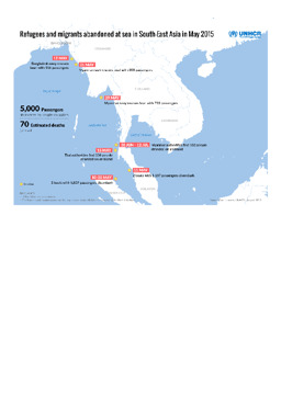
Situation map on refugees and migrants abandoned at sea in South-East Asia in May 2015
Refugees and migrants abandoned at sea in South-East Asia in May 2015 (Map or infographic, English)
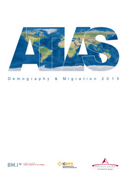
Infographics: Thematic atlas on demography and migration, globally and in Europe (population density; population age; migration; displacement)
Atlas Demography & Migration 2015 (Map or infographic, English)
Documents found: 495
