Maps
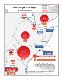
Situation map on the distribution of Somali refugees in the region (as of 20 February 2013)
Somali Refugees in the Region; As of 20th February 2013 (Map or infographic, English)
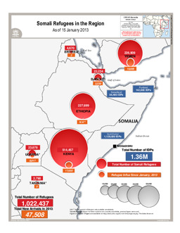
Situation map on the distribution of Somali refugees in the region (as of 15 January 2013)
Somali Refugees in the Region; As of 15 January 2013 (Map or infographic, English)
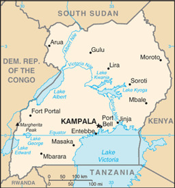
Small map
Uganda (Small Map) 2013 (Map or infographic, English)
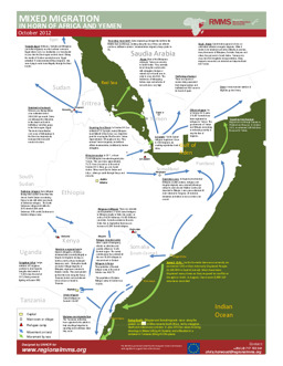
Infographic on mixed migration in the Horn of Africa and Yemen (as of October 2012)
Mixed Migration in the Horn of Africa and Yemen (Map or infographic, English)
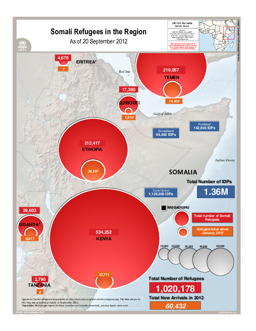
Situation map on the distribution of Somali refugees in the region (as of 20 September 2012)
Somali Refugees in the Region; As of 20 September 2012 (Map or infographic, English)
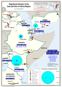
Situation map on the distribution of registered Somalis in Djibouti, Eritrea, Ethiopia, Kenya, Tanzania, Uganda and Yemen (as of 19 August 2012)
Registered Somalis in the East and Horn of Africa Region (Map or infographic, English)
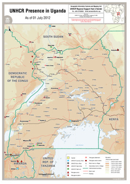
Map of UNHCR presence in Uganda
UNHCR Presence in Uganda (Map or infographic, English)
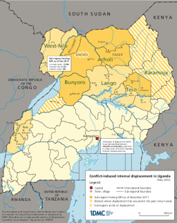
Map on conflict-induced internal displacement (May 2012)
Conflict-induced displacement in Uganda, Internal Displacement Monitoring Centre (IDMC) (May 2012) (Map or infographic, English)
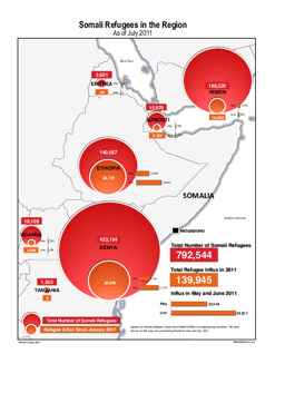
Situation map on displacement (distribution of Somali refugees in the region) (as of July 2011)
Somali Refugees in the Region; As of July 2011 (Map or infographic, English)
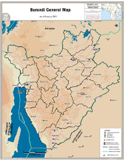
Map of Burundi general Map - as of February 2011
Burundi General Map - as of February 2011 (Map or infographic, English)

Documents found: 230
