May 2023 | REACH Initiative, ACTED - Agency for Technical Cooperation and Development (Author)
Sri Lanka
Batticaloa, Colombo, Kilinochchi, Nuwara Eliya and corresponding districts: Assessment on perceptions of communities affected by economic crisis, their needs, priorities and preferences (covering December 2022 - May 2023)
Evidence-gathering on community perceptions, priority needs and preferences in Sri Lanka (Map or infographic, English)
14 December 2018 | UN OCHA – UN Office for the Coordination of Humanitarian Affairs (Author), published by ReliefWeb
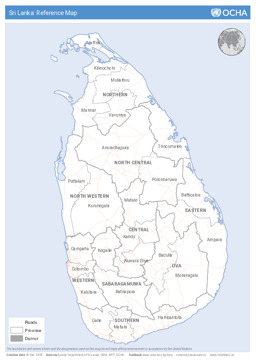
Sri Lanka
Political map with administrative divisions (province level and district level) and roads
Sri Lanka: Reference Map (Map or infographic, English)
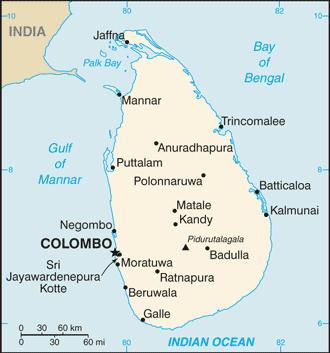
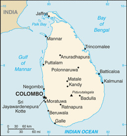
2016 | CIA – Central Intelligence Agency (Author), published by University of Texas Libraries
Sri Lanka
Small map of Sri Lanka
Sri Lanka (Small Map) 2016 (Map or infographic, English)
August 2015 | BFA Staatendokumentation (Austrian Federal Office for Immigration and Asylum, COI unit) (Author)
Afghanistan, Albania, Algeria, Angola, Argentina, Armenia, Australia, Austria, Azerbaijan, Bahrain, Bangladesh, Belarus, Belgium, Benin, Bhutan, Bolivia, Bosnia and Herzegovina, Botswana, Brazil, Bulgaria, Burkina Faso, Burundi, Cambodia, Cameroon, Canada, Central African Republic, Chad, Chile, China, Colombia, Congo, Congo, Democratic Republic, Costa Rica, Croatia, Cuba, Cyprus, Czech Republic, Côte d'Ivoire, Denmark, Djibouti, Dominican Republic, Ecuador, Egypt, El Salvador, Equatorial Guinea, Eritrea, Estonia, Eswatini, Ethiopia, Finland, France, Gabon, Gambia, Georgia, Germany, Ghana, Greece, Guatemala, Guinea, Guinea-Bissau, Haiti, Honduras, Hungary, Iceland, India, Indonesia, Iran, Iraq, Ireland, Israel, Italy, Jamaica, Japan, Jordan, Kazakhstan, Kenya, Korea, Democratic People's Republic, Korea, Republic, Kosovo, Kuwait, Kyrgyzstan, Lao People's Democratic Republic, Latvia, Lebanon, Lesotho, Liberia, Libya, Liechtenstein, Lithuania, Luxembourg, Madagascar, Malawi, Malaysia, Maldives, Mali, Malta, Mauritania, Mexico, Moldova, Republic, Mongolia, Montenegro, Morocco, Mozambique, Myanmar, Namibia, Nepal, Netherlands, New Zealand, Nicaragua, Niger, Nigeria, North Macedonia, Norway, Oman, Pakistan, Panama, Paraguay, Peru, Philippines, Poland, Portugal, Qatar, Romania, Russian Federation, Rwanda, Saudi Arabia, Senegal, Serbia, Sierra Leone, Singapore, Slovakia, Slovenia, Somalia, South Africa, South Sudan, Spain, Sri Lanka, State of Palestine, Sudan, Suriname, Sweden, Switzerland, Syrian Arab Republic, Taiwan, Tajikistan, Tanzania, United Republic, Thailand, Timor-Leste, Togo, Tunisia, Turkmenistan, Türkiye, Uganda, Ukraine, United Arab Emirates, United Kingdom, United States of America, Uruguay, Uzbekistan, Venezuela, Vietnam, Western Sahara, Yemen, Zambia, Zimbabwe
Infographics: Thematic atlas on demography and migration, globally and in Europe (population density; population age; migration; displacement)
Atlas Demographie & Migration 2015 (Map or infographic, German)
August 2015 | BFA Staatendokumentation (Austrian Federal Office for Immigration and Asylum, COI unit) (Author)
Afghanistan, Albania, Algeria, Angola, Argentina, Armenia, Australia, Austria, Azerbaijan, Bahrain, Bangladesh, Belarus, Belgium, Benin, Bhutan, Bolivia, Bosnia and Herzegovina, Botswana, Brazil, Bulgaria, Burkina Faso, Burundi, Cambodia, Cameroon, Canada, Central African Republic, Chad, Chile, China, Colombia, Congo, Congo, Democratic Republic, Costa Rica, Croatia, Cuba, Cyprus, Czech Republic, Côte d'Ivoire, Denmark, Djibouti, Dominican Republic, Ecuador, Egypt, El Salvador, Equatorial Guinea, Eritrea, Estonia, Eswatini, Ethiopia, Finland, France, Gabon, Gambia, Georgia, Germany, Ghana, Greece, Guatemala, Guinea, Guinea-Bissau, Haiti, Honduras, Hungary, Iceland, India, Indonesia, Iran, Iraq, Ireland, Israel, Italy, Jamaica, Japan, Jordan, Kazakhstan, Kenya, Korea, Democratic People's Republic, Korea, Republic, Kosovo, Kuwait, Kyrgyzstan, Lao People's Democratic Republic, Latvia, Lebanon, Lesotho, Liberia, Libya, Liechtenstein, Lithuania, Luxembourg, Madagascar, Malawi, Malaysia, Maldives, Mali, Malta, Mauritania, Mexico, Moldova, Republic, Mongolia, Montenegro, Morocco, Mozambique, Myanmar, Namibia, Nepal, Netherlands, New Zealand, Nicaragua, Niger, Nigeria, North Macedonia, Norway, Oman, Pakistan, Panama, Paraguay, Peru, Philippines, Poland, Portugal, Qatar, Romania, Russian Federation, Rwanda, Saudi Arabia, Senegal, Serbia, Sierra Leone, Singapore, Slovakia, Slovenia, Somalia, South Africa, South Sudan, Spain, Sri Lanka, State of Palestine, Sudan, Suriname, Sweden, Switzerland, Syrian Arab Republic, Taiwan, Tajikistan, Tanzania, United Republic, Thailand, Timor-Leste, Togo, Tunisia, Turkmenistan, Türkiye, Uganda, Ukraine, United Arab Emirates, United Kingdom, United States of America, Uruguay, Uzbekistan, Venezuela, Vietnam, Western Sahara, Yemen, Zambia, Zimbabwe
Infographics: Thematic atlas on demography and migration, globally and in Europe (population density; population age; migration; displacement)
Atlas Demography & Migration 2015 (Map or infographic, English)
1 July 2015 | IDMC – Internal Displacement Monitoring Centre (formerly Global IDP Project) (Author)

Sri Lanka
Map on internal displacement as of July 2015
Internal displacement in Sri Lanka (Map or infographic, English)
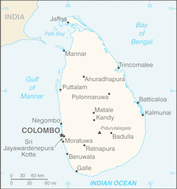
2013 | U.S. Central Intelligence Agency (Author), published by University of Texas Libraries
Sri Lanka
Small map
Sri Lanka (Small Map) 2013 (Map or infographic, English)
December 2010 | UN OCHA (Author), published by IDMC – Internal Displacement Monitoring Centre (formerly Global IDP Project)
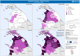
Sri Lanka
Map on resettlement progress in Northern Sri Lanka since October 2009, as of 3 December 2010
Resettlement progress, Northern Province, 3 December 2010, UN Office for the Coordination of Humanitarian Affairs (UN OCHA) (December 2010) (Map or infographic, English)
June 2010 | Government of Sri Lanka; UNCS (Author), published by ReliefWeb
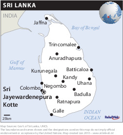
Sri Lanka
Political map
Sri Lanka (Map or infographic, English)
18 April 2008 | UN OCHA – UN Office for the Coordination of Humanitarian Affairs (Author)
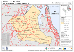
Sri Lanka
Administrative map of the DS-Navithanveli, Ampara District
Administrative map DS-Navithanveli Ampara District (Map or infographic, English)