Maps
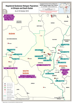
Situation map on the distribution of the registered Sudanese refugee population in Ethiopia and South Sudan (as of 24 October 2012)
Registered Sudanese Refugee Population in Ethiopia and South Sudan (Map or infographic, English)
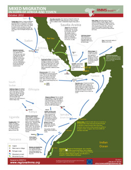
Infographic on mixed migration in the Horn of Africa and Yemen (as of October 2012)
Mixed Migration in the Horn of Africa and Yemen (Map or infographic, English)
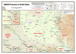
Situation map on UNHCR presence (as of August 2012)
UNHCR Presence in South Sudan (As of August 2012) (Map or infographic, English)
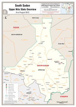
Upper Nile State: Situation map on refugee settlements und UNHCR offices as well as main towns, with administrative divisions (county level) (as of August 2012)
South Sudan Upper Nile State Overview (Map or infographic, English)
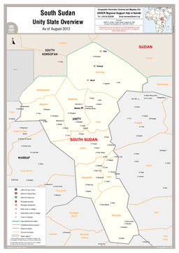
Unity State: Situation map on refugee settlements und UNHCR offices as well as main towns, with administrative divisions (county level) (as of August 2012)
South Sudan; Unity State Overview (Map or infographic, English)
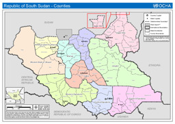
Political map with administrative divisions (state level and county level)
Republic of South Sudan - Counties (as of 16 July 2012) (Map or infographic, English)
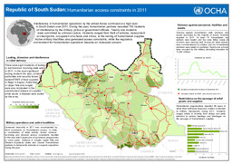
Infographic on humanitarian access constraints in 2011
Republic of South Sudan: Humanitarian access constraints in 2011 (as of 8 Feb 2012) (Map or infographic, English)
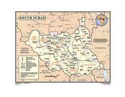
Thematic map on infrastructure (roads; airports), with water bodies, main cities and administrative divisions (state level) (October 2011)
South Sudan (Map or infographic, English)

Situation map on the distribution of returnees, with administrative divisions (state level and county level) (covering 30 October 2010 to 13 September 2011)
Number of Returnees by County, 30 Oct. 2010 - 13 Sept. 2011, UN Office for the Coordination of Humanitarian Affairs (UN OCHA) (September 2011) (Map or infographic, English)
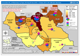
Situation map showing cumulative figure of returnees, by type, with administrative divisions (state level) (covering 30 October 2010 to 13 September 2011)
Cumulative No. of Returnees, by Type, Arriving 30 Oct. 2010 - 13 Sept. 2011, UN Office for the Coordination of Humanitarian Affairs (UN OCHA) (September 2011) (Map or infographic, English)
Documents found: 455
