Maps
Sitation map on the distribution of refugees from South Sudan, with administrative divisions (state level) (as of 30 May 2014)
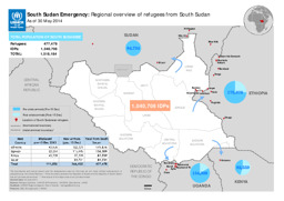
South Sudan Emergency: Regional overview of refugees from South Sudan; As of 30 May 2014 (Map or infographic, English)
Situation map on IDPs, refugees, UNHCR presence and areas with violence
South Sudan Refugee Situation - UNHCR Regional Update, 15 (Map or infographic, English)
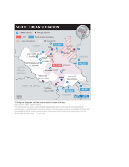
Situation map on IDPs, refugees, UNHCR presence and areas with violence, with administrative divisions (state level) and main cities (as of 17 April 2014)
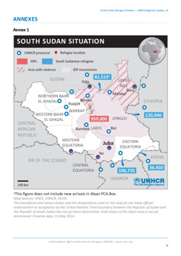
South Sudan Situation (Map or infographic, English)
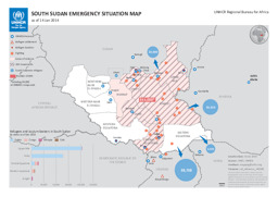
Situation map of UNHCR presence, refugee settlements, clashes, IDPs, etc., with administrative divisions (state level) (as of 14 January 2014)
South Sudan emergency situation map as of 14 Jan 2014 (Map or infographic, English)
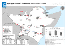
Situation map of camps and settlements of South Sudanese refugees in South Sudan, Ethiopia, Kenya and Uganda (as of 14 January 2014)
South Sudan Emergency Situation Map: South Sudanese Refugees; 14 January 2014 (Map or infographic, English)
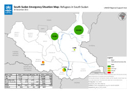
Situation map on number and origin of refugees in South Sudan, with administrative divisions (state level) (as of 30 December 2013)
South Sudan Emergency Situation Map: Refugees in South Sudan; 30 December 2013 (Map or infographic, English)
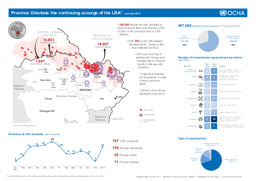
Infographic of displacement caused by activities of the Lord's Resistance Army in the Democratic Republic of the Congo, the Central African Republic and South Sudan (as of January 2013)
Democratic Republic of Congo: Province Orientale: the continuing scourge of the LRA - January 2013 (Map or infographic, English)

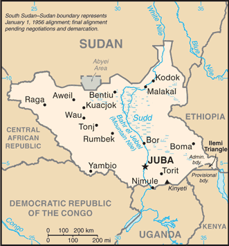
Small map with water bodies and main cities
South Sudan (Small Map) 2013 (Map or infographic, English)
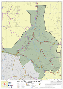
Upper Nile State: Thematic map on infrastructure (roads; airports; ports) (as of 25 November 2012)
Upper Nile State; Detailed Transport Map (as of 25 Nov 2012) (Map or infographic, English)
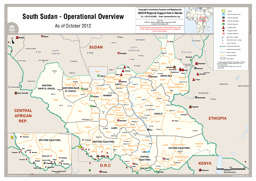
Situation map on the distribution of of refugee camps and refugee settlements, with administrative divisions (state level; county level) (as of October 2012)
South Sudan - Operational Overview (Map or infographic, English)
Documents found: 455
