Maps
Situation map on the distribution of refugee camps and refugee settlements (as of 25 March 2015)
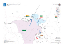
Nigeria Situation: Operational context; 25 March (Map or infographic, English)
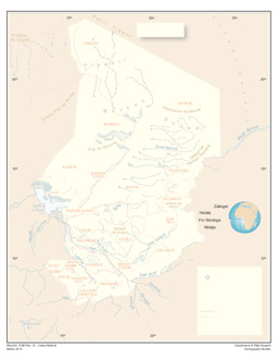
Situation map on administrative borders (as of 2 March 2015)
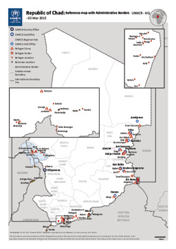
Republic of Chad: Reference map with Administrative Borders; 02 Mar 2015 (Map or infographic, English)
Situation map on the impact of refugees from Nigeria (as of 2 March 2015)
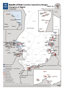
Republic of Chad: Countries impacted by Refugee Emergency in Nigeria; 02 Mar 2015 (Map or infographic, English)
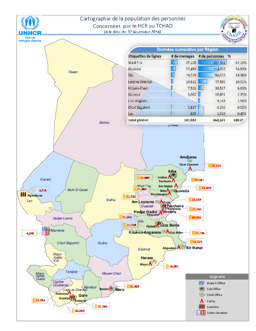
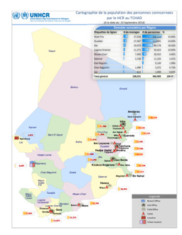
Situation map on persons of concern to UNHCR (as of 2 November 2014)
Cartographie de la population des personnes concernées par le HCR au Tchad (A la date du: 02 Novembre 2014) (Map or infographic, English)
Situation map on persons of concern to UNHCR (as of 14 September 2014)
Cartographie de la population des personnes concernées par le HCR au Tchad (A la date du: 14 September 2014) (Map or infographic, English)
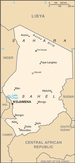
Thematic map with administrative divisions (province level), main cities and water bodies on infrastructure (roads; railway; airports)
Chad (Map or infographic, English)
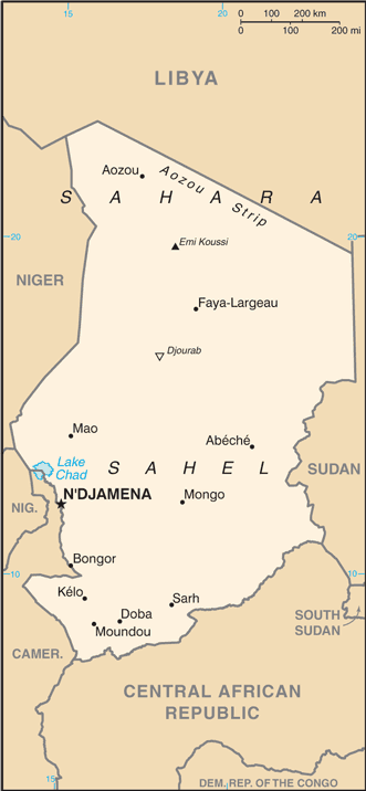
Small map
Chad (Small Map) 2013 (Map or infographic, English)
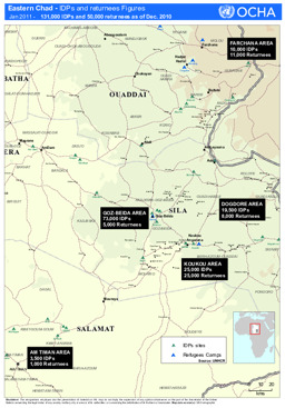
Eastern Chad: Situation map on the distribution of IDPs and returnees (as of January 2011)
Eastern Chad - IDPs and returnee figures (Jan 2011) (Map or infographic, English)
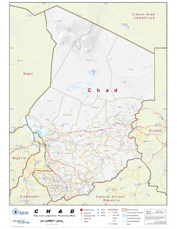
Thematic map with administrative divisions (province level), major cities and water bodies on infrastructure (roads; railway; airports)
Chad: General Logistics and Planning Map (21 Feb 2011) (Map or infographic, English)
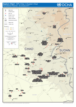
Eastern Chad: Situation map on humanitarian presence and IDP sites (as of January 2011)
IDPs Sites in Eastern Chad - Humanitarian Presence (as of Jan 2011) (Map or infographic, English)
Documents found: 283
