Maps
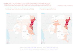
Update on conflict-related incidents according to the Armed Conflict Location & Event Data Project (covering 1st quarter 2021)
Democratic Republic of Congo, first quarter 2021: Update on incidents according to the Armed Conflict Location & Event Data Project (ACLED) (Map or infographic, English)
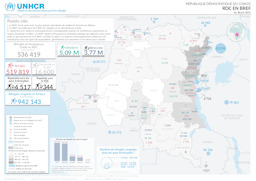
Situation map on the distribution of refugees, asylum seekers, IDPs and returnees (as of 30 June 2021)
République Démocratique du Congo; RDC en Bref; Au 30 juin 2021 (Map or infographic, French)
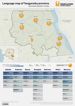
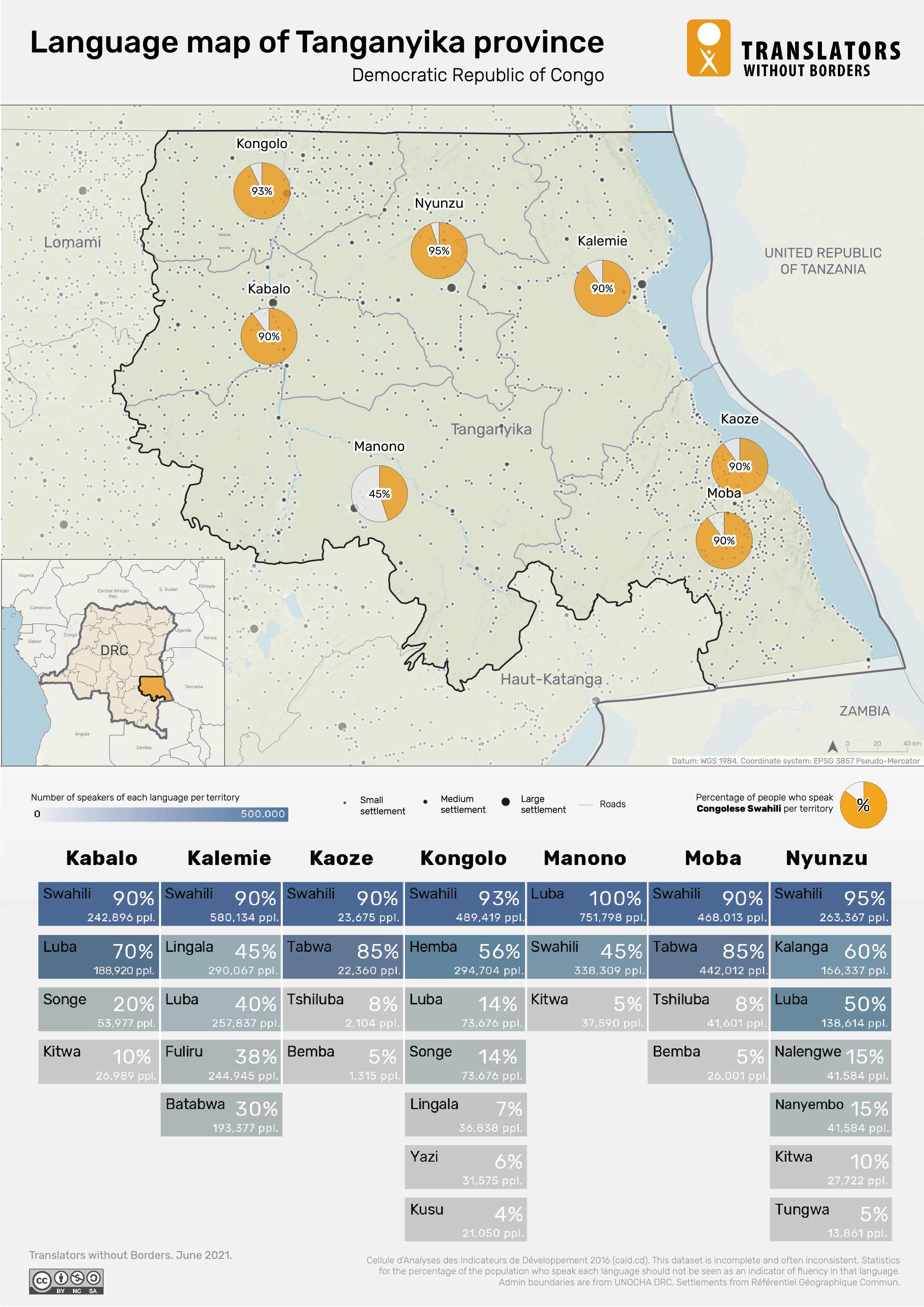
Tanganyika province: Infographic on the distribution of languages
Language map of Tanganyika province; Democratic Republic of Congo (Map or infographic, English)
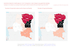
Update on conflict-related incidents according to the Armed Conflict Location & Event Data Project (covering 2nd quarter 2020)
Democratic Republic of Congo, second quarter 2020: Update on incidents according to the Armed Conflict Location & Event Data Project (ACLED) (Map or infographic, English)
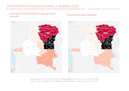
Update on conflict-related incidents according to the Armed Conflict Location & Event Data Project (covering 2nd quarter 2020)
Demokratische Republik Kongo, 2. Quartal 2020: Kurzübersicht über Vorfälle aus dem Armed Conflict Location & Event Data Project (ACLED) (Map or infographic, German)
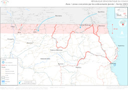
Situation map on areas affected by kidnappings (covering January to February 2021)
République Démocratique du Congo; Axes / zones concernés par les enlèvements janvier - février 2021; au 25 Mar 2021 (Map or infographic, French)
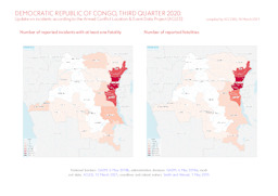
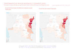
Update on conflict-related incidents according to the Armed Conflict Location & Event Data Project (covering 3rd quarter 2020)
Democratic Republic of Congo, third quarter 2020: Update on incidents according to the Armed Conflict Location & Event Data Project (ACLED) (Map or infographic, English)
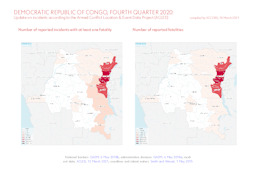
Update on conflict-related incidents according to the Armed Conflict Location & Event Data Project (covering 4th quarter 2020)
Democratic Republic of Congo, fourth quarter 2020: Update on incidents according to the Armed Conflict Location & Event Data Project (ACLED) (Map or infographic, English)
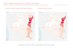
Update on conflict-related incidents according to the Armed Conflict Location & Event Data Project (covering 2020)
Democratic Republic of Congo, year 2020: Update on incidents according to the Armed Conflict Location & Event Data Project (ACLED) (Map or infographic, English)
Update on conflict-related incidents according to the Armed Conflict Location & Event Data Project (covering 3rd quarter 2020)
Demokratische Republik Kongo, 3. Quartal 2020: Kurzübersicht über Vorfälle aus dem Armed Conflict Location & Event Data Project (ACLED) (Map or infographic, German)
Documents found: 552
