Maps
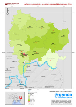
Map on shelter in the Luhansk region
Luhansk region shelter operation map as of 26 of January 2015 (Map or infographic, English)
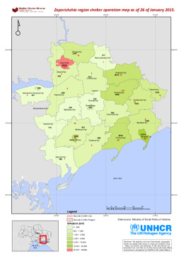
Map on shelter in the Zaporizhia region
Zaporizhzhia region shelter operation map as of 26 of January 2015 (Map or infographic, English)
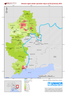
Map on shelter in the Donetsk region
Donetsk region shelter operation map as of 26 of January 2015 (Map or infographic, English)
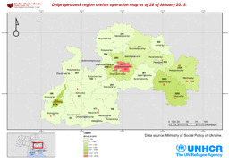
Map on shelter in the Dnipropetrovsk region
Dnipropetrovsk region shelter operation map as of 26 of January 2015 (Map or infographic, English)
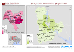
Maps on distribution of IDPs in Kiev city and oblast
Kyiv City and Oblast - IDPs distribution as of 22 of January 2015 (Map or infographic, English)
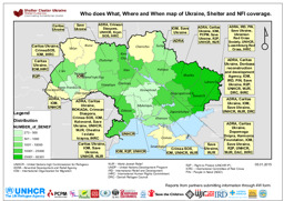
Map on shelter and non-food items coverage in Ukraine
Who does What, Where and When map of Ukraine, Shelter and NFI coverage (Map or infographic, English)
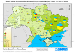
Map on internal displacement
Ukraine internal displacement map from temporary occupied territory and zone of ATO as of 22.12.2014 (Map or infographic, English)
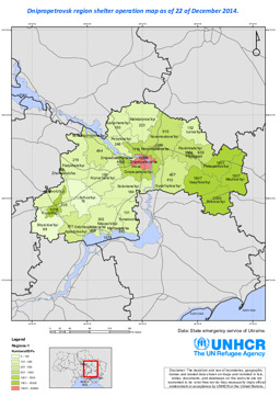
Map on shelter in the Dnipropetrovsk region
Dnipropetrovsk region shelter operation map as of 22 of December 2014 (Map or infographic, English)
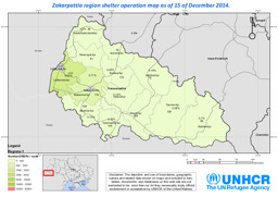
Map on shelter in the Zakarpattia region
Zakarpattia region shelter operation map as of 15 of December 2014 (Map or infographic, English)
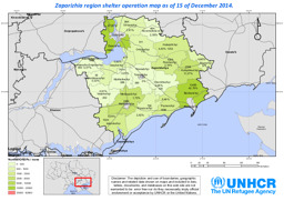
Map on shelter in the Zaporizhia region
Zaporizhia region shelter operation map as of 15 of December 2014 (Map or infographic, English)
Documents found: 136
