Maps
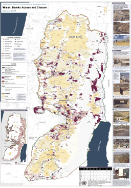
West Bank: Situation map on open and closed border crossings, checkpoints, road gates, earth walls, trenches and road barriers
Occupied Palestinian Territory: West Bank - Access and closures (OCHA) (Map or infographic, English)
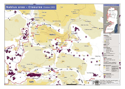
Nablus: Situation map on closures of checkpoints, partial checkpoints, observation towers, road gates, roadblocks, earth mounds, earth walls and trenches
Occupied Palestinian Territory - Nablus: Closures (as of October 2005) (OCHA) (Map or infographic, English)
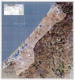
Gaza Strip: Political map
Gaza Strip May 2005 scale 1:65,000 (Map or infographic, English)
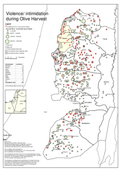
Situation map on violence and intimidation during olive harvest
Occupied Palestinian Territory: Violence/ intimidation during Olive Harvest (OCHA) (Map or infographic, English)

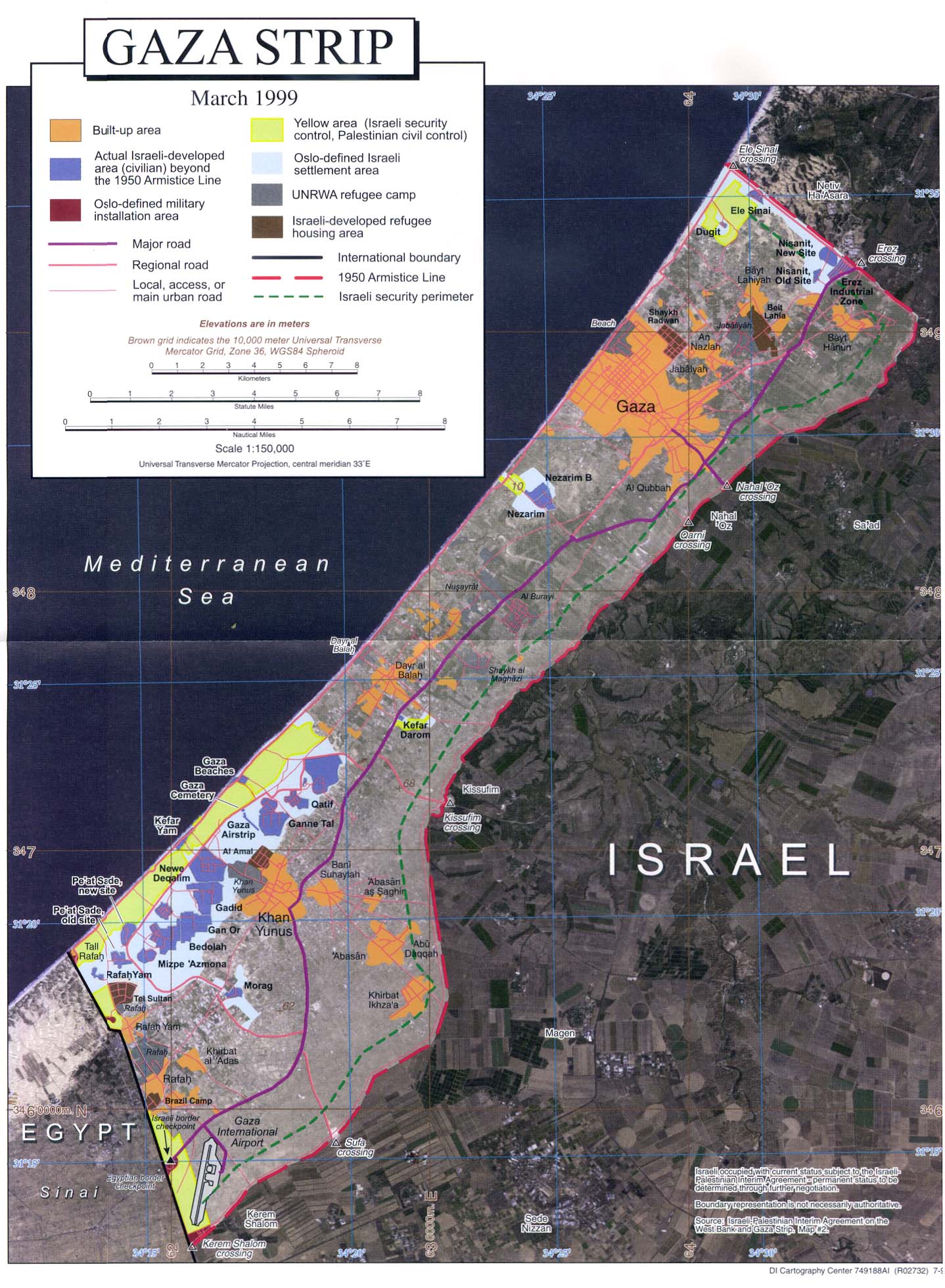
Gaza Strip: Political map
Gaza Strip July 1999 original scale 1:150,000 (Map or infographic, English)
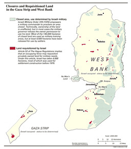
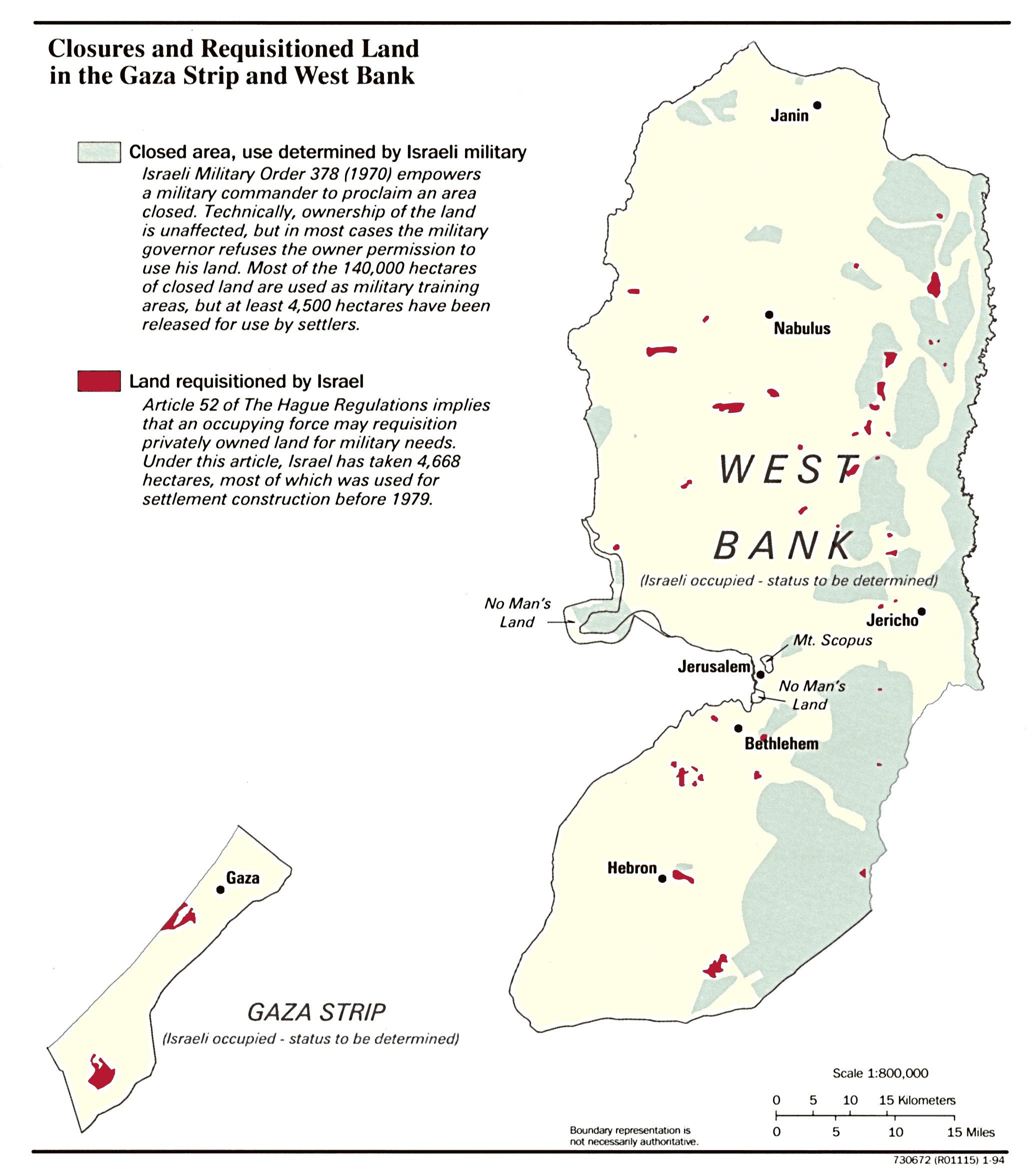
Gaza Strip and the West Bank: Infographic on closures and requisitioned land
Gaza Strip and the West Bank, Closures and Requisitioned Land in January 1994 (Map or infographic, English)
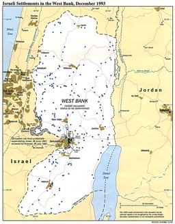
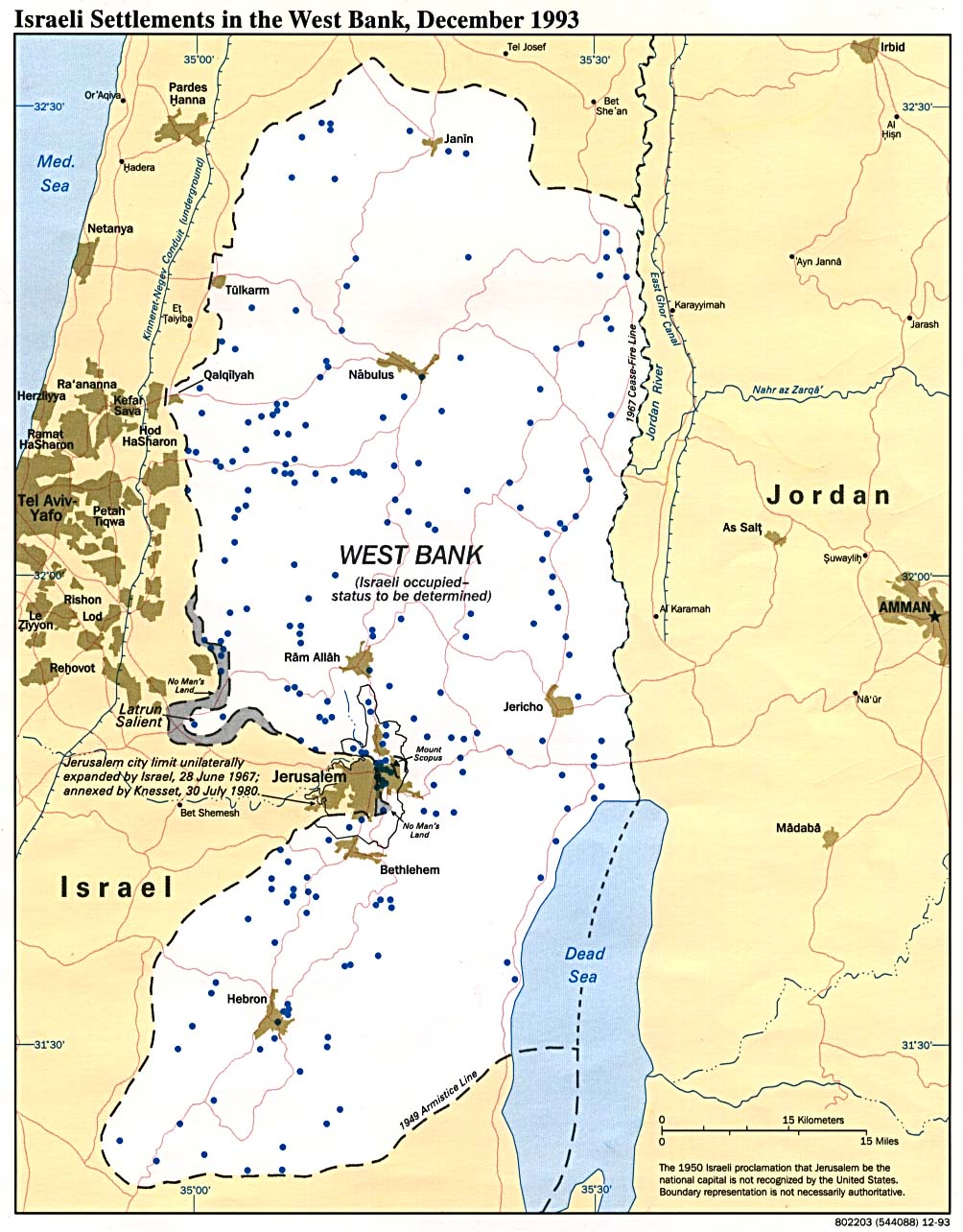
West Bank: Situation map on Israeli settlements
Israeli Settlements in the West Bank 1993 (Map or infographic, English)

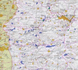
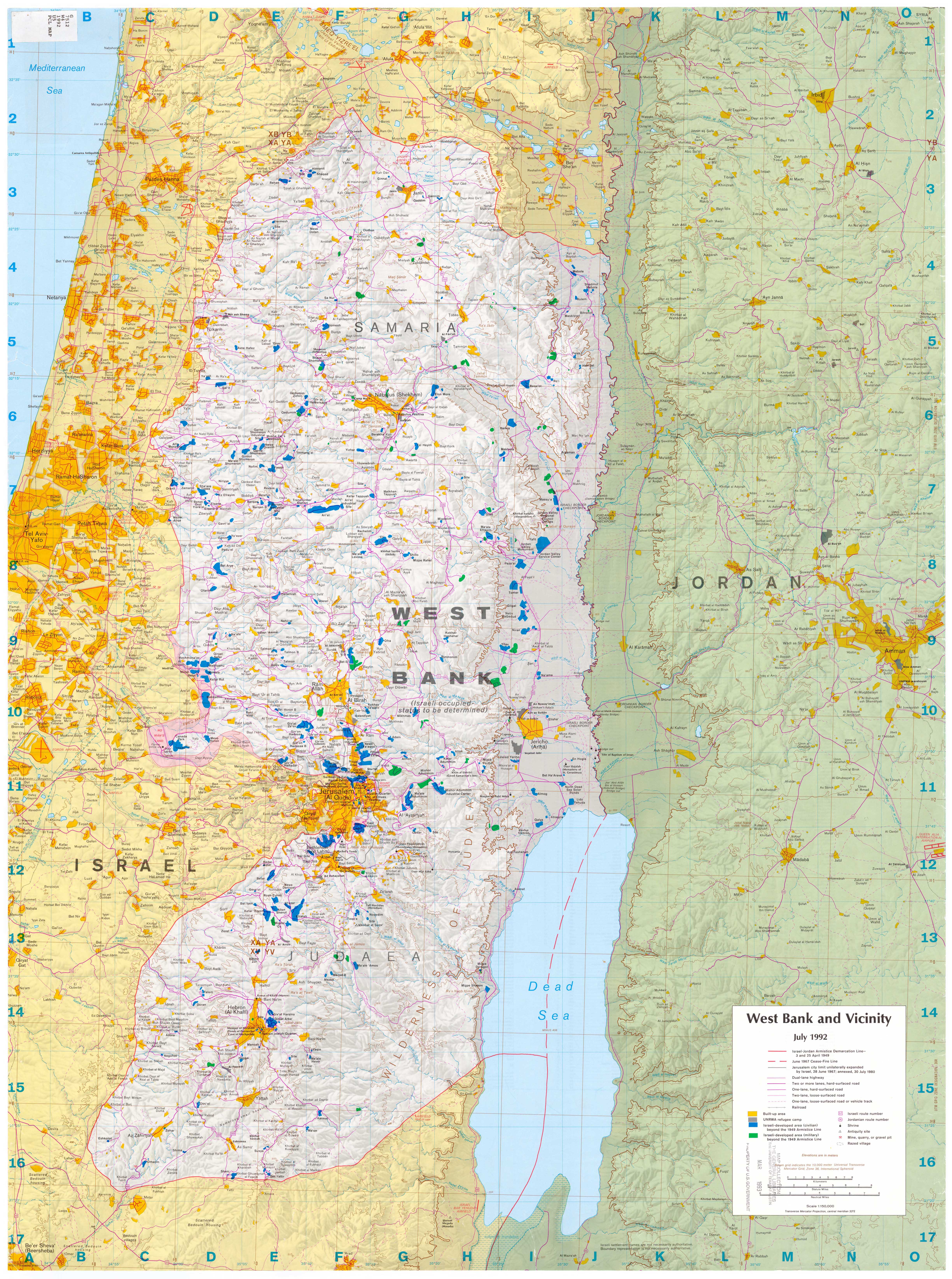
West Bank: Political map
West Bank - Entire Map (Map or infographic, English)
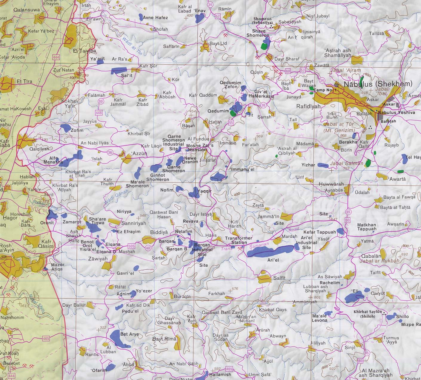
Political map of western West Bank and Nablus
West Bank - Nabulus and West (Map or infographic, English)
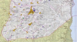
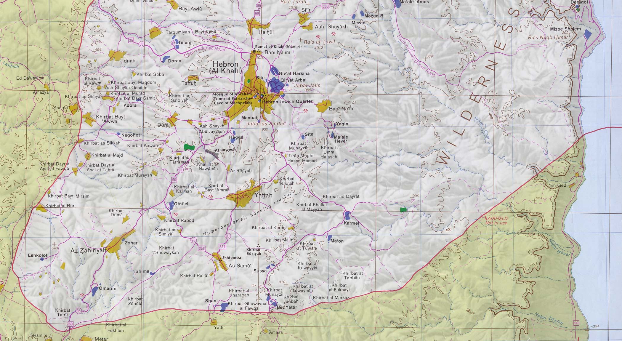
Political map of southern West Bank
West Bank - Far South Including Hebron (Map or infographic, English)

Documents found: 34
