This page gives you an overview on maps about Pakistan collected on ecoi.net. More maps are available in our full-text search.
Ethnic & religious groups and topography
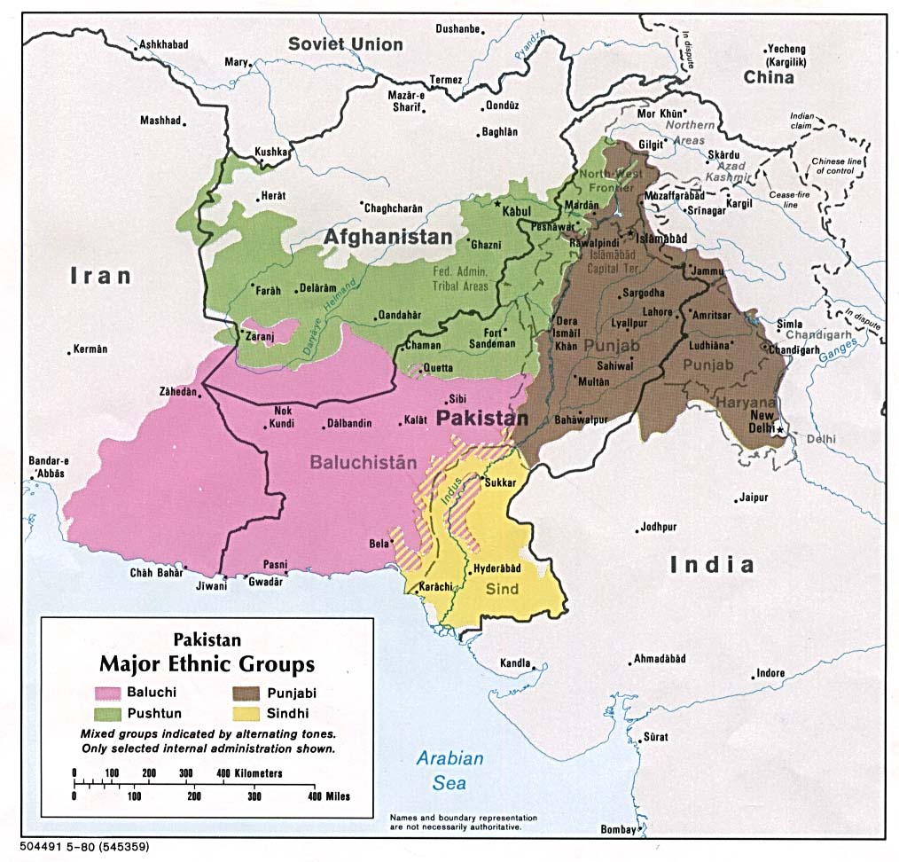
A map by the US Central Intelligence Agency (CIA) from May 1980 shows the major ethnic groups in the country:

Population map on the distribution of the major ethnic groups
Pakistan (Major Ethnic Groups) 1980 (Map or infographic, English)
In 2017, the Federal Ministry of Interior of Austria (BMI) published an atlas containing maps on the country’s topography (p.16), religious groups (p. 26) and ethnic groups (p. 36):
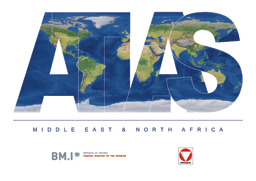
Middle East, North Africa and Arabian peninsula: Population maps, thematic maps and physical maps with main cities (religious groups; ethnic groups; oil and gas)
Atlas: Middle East & North Africa (Map or infographic, English)
Administrative divisions
A map by the Information, Documentation and Research Division (DIDR) of OFPRA from June 2021 shows administrative divisions on the province level and main cities:
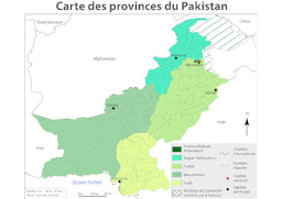
Political map with administrative divisions (provincial level) and main cities
Carte des provinces du Pakistan (Map or infographic, French)
A map by the US Central Intelligence Agency (CIA) from 2004 shows administrative divisions on a regional level as well as roads and the railway system in Kashmir:
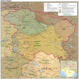
Kashmir region: Physical map with infrastructure (roads; railroad) and administrative divisions (regional level)
Kashmir Region 2004 (Map or infographic, English)

Cities
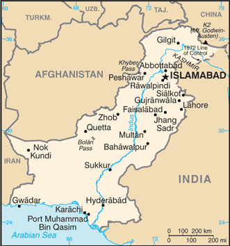
In 2016, the US Central Intelligence Agency (CIA) published a map with major cities:
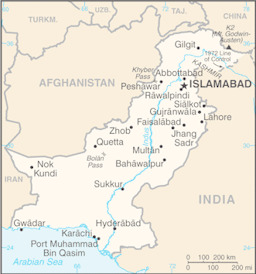
Small political map with main cities
Pakistan (Small Map) 2016 (Map or infographic, English)
More maps
More maps and infographics with the option to use filters can be found in the ecoi.net search: Pakistan maps on ecoi.net. Please note that the recognition of text in graphical documents such as maps often does not work well. This means that place names often can't be found in the full-text search, even when the name is visible on a map.

- Austrian Red Cross
- Austrian Centre for Country of Origin and Asylum Research and Documentation (ACCORD)
- Wiedner Hauptstraße 32, 1041 Wien
- T +43 1 589 00 583
- F +43 1 589 00 589
- info@ecoi.net
ecoi.net is run by the Austrian Red Cross (department ACCORD) in cooperation with Informationsverbund Asyl & Migration. ecoi.net is funded by the Asylum, Migration and Integration Fund, the Austrian Ministry of the Interior and Caritas Austria. ecoi.net is supported by ECRE & UNHCR.