Maps
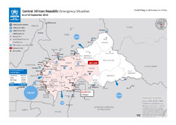
Situation map on refugees as well as internally displaced people and UNHCR units in and around the Central Africain Republic (as of 19 September 2014)
Central African Republic; Emergency Situation; As of 19 September 2014 (Map or infographic, English)
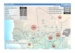
Situation map on displacement (distribution of refugees and IDPs) (as of 31 August 2014)
Situation au Mali; Réfugiés, rapatriés et personnes déplacées internes au Mali; 31 août 2014 (Map or infographic, English)

Situation map on refugees as well as internally displaced people and UNHCR units in and around the Central Africain Republic (as of 4 August 2014)
Central African Republic Emergency Situation as of 4 August 2014 (Map or infographic, English)
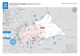
Situation map on refugees as well as internally displaced people and UNHCR units in and around the Central Africain Republic (as of 13 June 2014)
Central African Republic; Emergency Situation as of 13 June 2014 (Map or infographic, English)
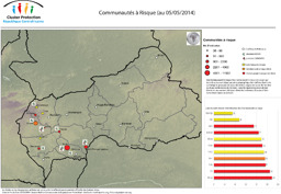
Situation map on communities at risk (as of 5 May 2014)
Communautés à Risque (Map or infographic, English)
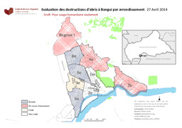
Situation map on shelter destruction in Bangui with administrative divisions (district level) (as of 27 April 2014)
Evaluation des destructions d'abris à Bangui par arrondissement (Map or infographic, English)
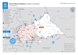
Situation map on refugees as well as internally displaced people and UNHCR units in and around the Central Africain Republic (as of 24 April 2014)
Central African Republic; Emergency Situation as of 24 April 2014 (Map or infographic, English)
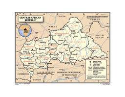
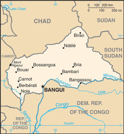
Thematic map on infrastrucutre (roads; railway; airports), with water bodies, main cities and administrative divisions (prefecture level)
Central African Republic (Map or infographic, English)
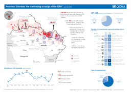
Infographic of displacement caused by activities of the Lord's Resistance Army in the Democratic Republic of the Congo, the Central African Republic and South Sudan (as of January 2013)
Democratic Republic of Congo: Province Orientale: the continuing scourge of the LRA - January 2013 (Map or infographic, English)
Small map with water bodies and main cities
Central African Republic (Small Map) 2013 (Map or infographic, English)

Documents found: 353
