Maps

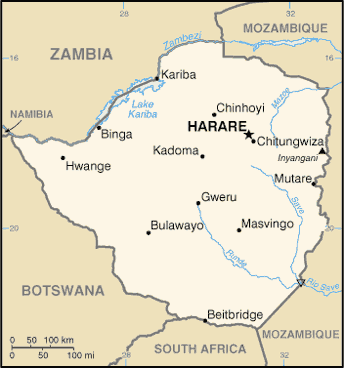
Small map
Zimbabwe (Small Map) 2013 (Map or infographic, English)
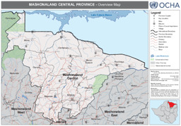
Mashonaland Central Province - Overview Map (as of 26 Oct 2009)
Zimbabwe: Mashonaland Central Province - Overview Map (as of 26 Oct 2009) (Map or infographic, English)
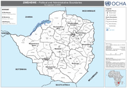
Political and Administrative Boundaries - As Updated in 2008 (as of 05 Oct 2009)
Zimbabwe: Political and Administrative Boundaries - As Updated in 2008 (as of 05 Oct 2009) (Map or infographic, English)
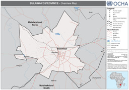
Bulawayo Province - Overview Map (as of 26 Oct 2009)
Zimbabwe: Bulawayo Province - Overview Map (as of 26 Oct 2009) (Map or infographic, English)
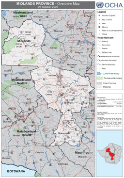
Midlands Province - Overview Map (as of 26 Oct 2009)
Zimbabwe: Midlands Province - Overview Map (as of 26 Oct 2009) (Map or infographic, English)
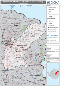
Mashonaland East Province - Overview Map (as of 26 Oct 2009)
Zimbabwe: Mashonaland East Province - Overview Map (as of 26 Oct 2009) (Map or infographic, English)
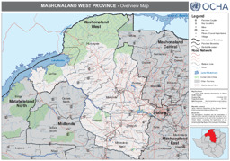
Mashonaland West Province - Overview Map (as of 26 Oct 2009)
Zimbabwe: Mashonaland West Province - Overview Map (as of 26 Oct 2009) (Map or infographic, English)
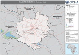
Harare Province - Overview Map (as of 26 Oct 2009)
Zimbabwe: Harare Province - Overview Map (as of 26 Oct 2009) (Map or infographic, English)
Matabeleland South Province - Transportation Network (as of 05 Oct 2009)
Zimbabwe: Matabeleland South Province - Transportation Network (as of 05 Oct 2009) (Map or infographic, English)
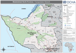
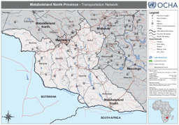
Matabeleland North Province - Transportation Network (as of 05 Oct 2009)
Zimbabwe: Matabeleland North Province - Transportation Network (as of 05 Oct 2009) (Map or infographic, English)
Documents found: 47
