Maps
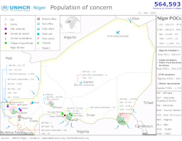
Map on the distribution of refugees, asylum seekers, IDPs and returnees
Niger; Population of concern; 31 - Oct - 2021 (Map or infographic, English)
Monthly infographic with administrative divisions (province level) on displacement (distribution of IDPs; distribution of returnees; distribution of refugees; distribution of asylum seekers) (as of September 2021)
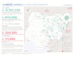
Nigeria: All Population Snapshot; September 2021 (Map or infographic, English)
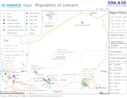
Map on the distribution of refugees, asylum seekers, IDPs and returnees
Niger; Population of concern; 30 - Sept - 2021 (Map or infographic, English)
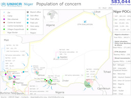
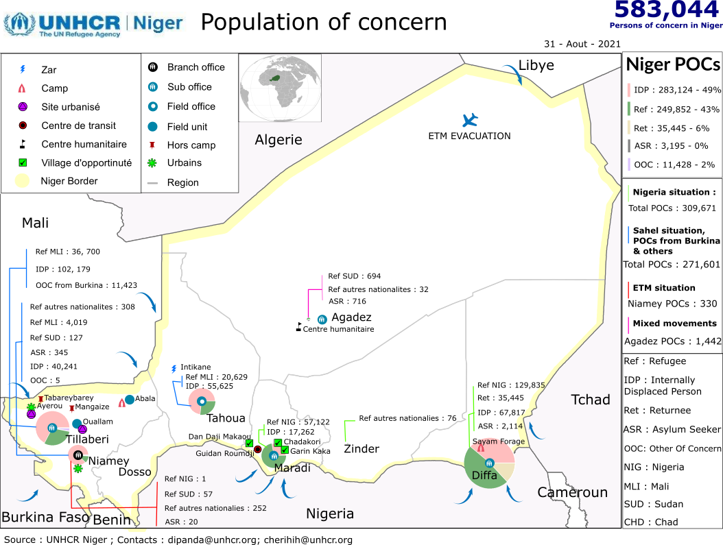
Map on the distribution of refugees, asylum seekers, IDPs and returnees
Niger; Population of concern; 31 - Aout - 2021 (Map or infographic, English)
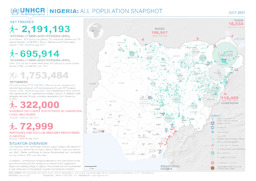
Monthly infographic with administrative divisions (province level) on displacement (distribution of IDPs; distribution of returnees; distribution of refugees; distribution of asylum seekers) (as of July 2021)
Nigeria: All Population Snapshot; July 2021 (Map or infographic, English)
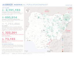
Monthly infographic with administrative divisions (province level) on displacement (distribution of IDPs; distribution of returnees; distribution of refugees; distribution of asylum seekers) (as of August 2021)
Nigeria: All Population Snapshot; August 2021 (Map or infographic, English)

Map on the distribution of refugees, asylum-seekers, IDPs and returnees
UNHCR Niger; Population of concern; 31 Juillet - 2021 (Map or infographic, English)
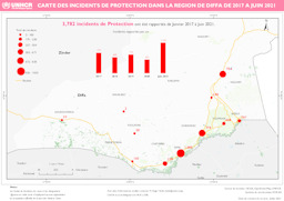
Map on protection incidents in the Diffa region (covering January 2017 to June 2021)
Carte des Incidents de Protection dans la Région de Diffa de 2017 à Juin 2021 (Map or infographic, French)
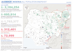
Monthly infographic with administrative divisions (province level) on displacement (distribution of IDPs; distribution of returnees; distribution of refugees; distribution of asylum seekers) (as of June 2021)
Nigeria: All Population Snapshot; June 2021 (Map or infographic, English)
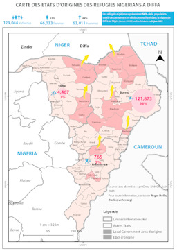
Diffa: Situation map on the states of origin of Nigerian refugees residing in the region (as of 30 June 2021)
Carte des États d'Origines des Réfugiés Nigérians à Diffa (Map or infographic, French)
Documents found: 448
