This page gives you an overview on maps about Iran collected on ecoi.net. More maps are available in our full-text search.
Ethnic groups and topography
A 2009 CIA country profile contains maps on ethno-religious groups, population density, mountains, major roads and water bodies:
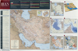
Physical map including population maps with administrative divisions as well as provincial capitals, major cities, roads and rivers on population density, ethnoreligious distribution and infrastructure
Iran (Wall Map) 2009 "Iran Country Profile" Iran map with insets: Population Density, Ethnoreligious Distribution, Key Petroleum Sector Facilities, Southern Caspian Energy Prospects and Strait Of Hormuz (Map or infographic, English)
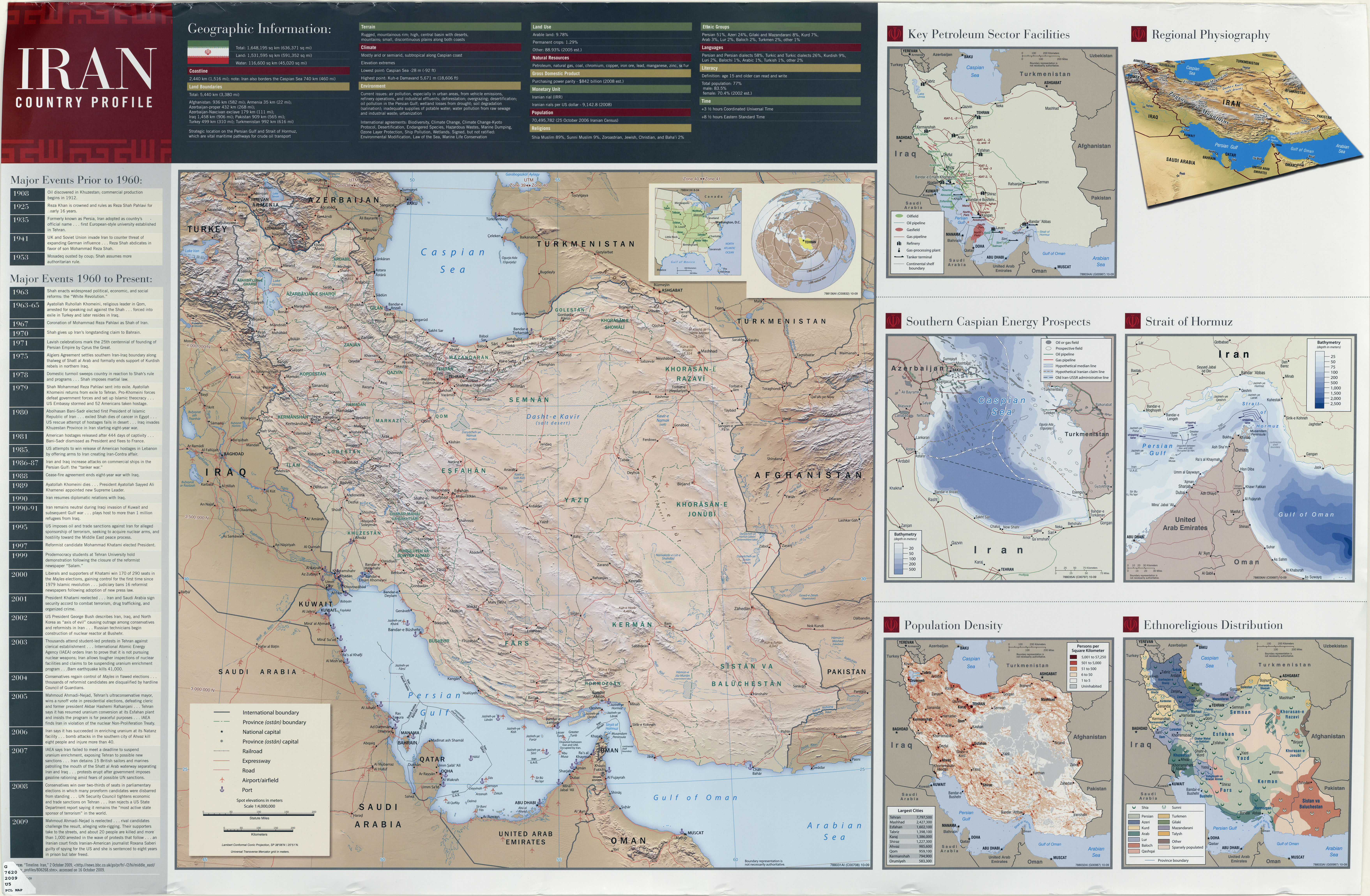
An atlas published by the Austrian ministries for interior and defense in 2017 contains maps on topography (p. 15-16), ethnic (p. 35-36) and religious groups (p. 25-26):
Middle East, North Africa and Arabian peninsula: Population maps, thematic maps and physical maps with main cities (religious groups; ethnic groups; oil and gas)
Atlas: Middle East & North Africa (Map or infographic, English)
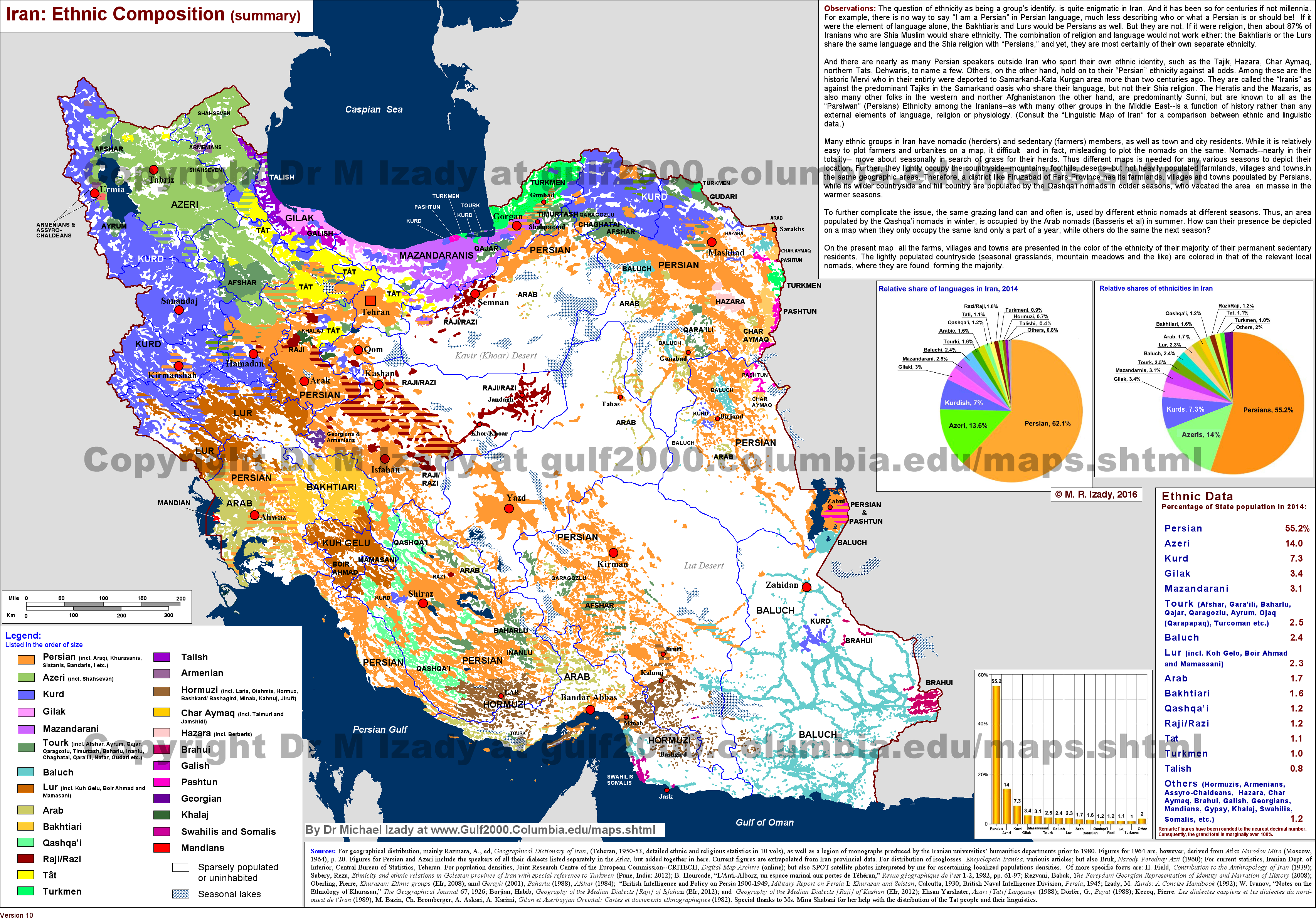
Dr. Michael Izady of the Columbia University's Gulf/2000 project published a map containing information on the distribution of ethnic groups:
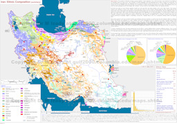
Population map: Infographic with ethnic groups (languages, ethnicities, background)
Iran: Ethnic composition (summary) (Map or infographic, English)
A 2020 country report by Australia's Department of Foreign Affairs and Trade also contains a map on the main ethnic groups (p. 2):
-
Country report (overview; political system; human rights; security; asylum claims; complementary protection claims; state protection; returnees; documentation)
DFAT Country Information Report Iran (Special or Analytical Report, English)
In the ecoi.net search, you can find more maps on:
Administrative divisons: Provinces
The Statistical Center of Iran published an undated map on its website that shows Iran's provinces after June 2010 (separation of Alborz province from Tehran). The map was accessible on the website as of 13 June 2022.
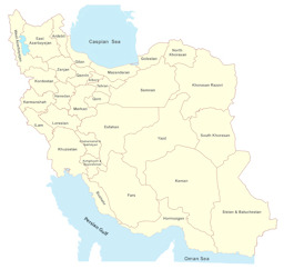
Political map with administrative divisions (province level) as of after June 2010
Iran (Map or infographic, English)

Find more political maps in the ecoi.net search.
More maps
More maps and infographics with the option to use filters can be found in the ecoi.net search: Iran maps and infographics on ecoi.net. Please note that the recognition of text in graphical documents such as maps often does not work well. This means that place names often can't be found in the full-text search, even when the name is visible on a map.
(Last update 12 March 2024)

- Austrian Red Cross
- Austrian Centre for Country of Origin and Asylum Research and Documentation (ACCORD)
- Wiedner Hauptstraße 32, 1041 Wien
- T +43 1 589 00 583
- F +43 1 589 00 589
- info@ecoi.net
ecoi.net is run by the Austrian Red Cross (department ACCORD) in cooperation with Informationsverbund Asyl & Migration. ecoi.net is funded by the Asylum, Migration and Integration Fund, the Austrian Ministry of the Interior and Caritas Austria. ecoi.net is supported by ECRE & UNHCR.