Maps
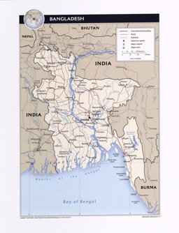
Thematic map on infrastructure (roads; railway; airports; ports) with water bodies and main cities
Bangladesh (Map or infographic, English)
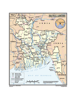
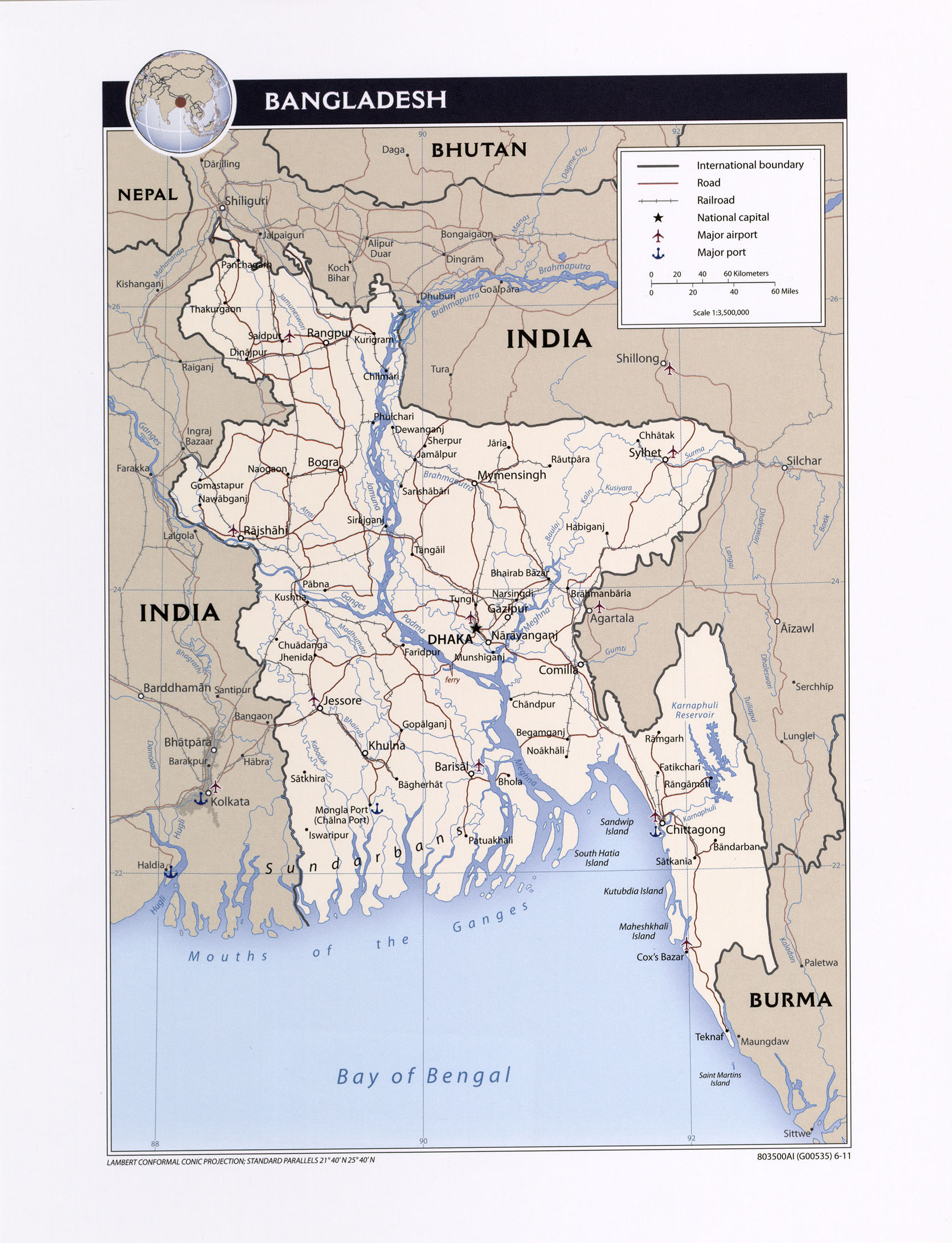
Thematic map on infrastructure with water bodies and main cities
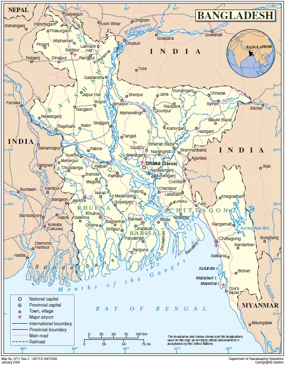
Reference Map of Bangladesh (UN Cartographic Section) (Map or infographic, English)
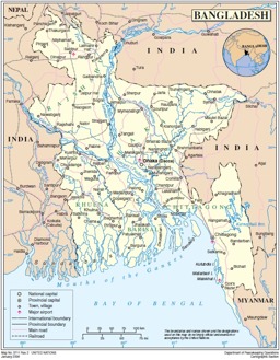
Thematic map on infrastructure (roads; railway; airports) with water bodies and main cities
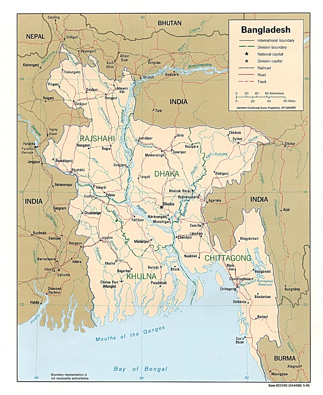
Bangladesh (Map or infographic, English)
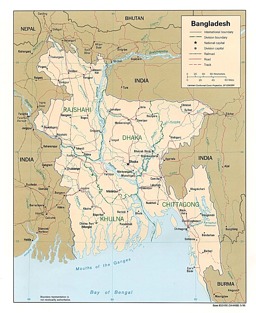
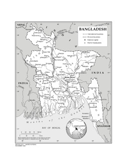
Thematic map on infrastructure (roads; railway) with water bodies and main cities
Political map (Map or infographic, English)
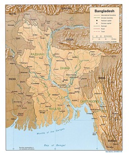
Thematic map on infrastructure (roads; railway) with water bodies and main cities
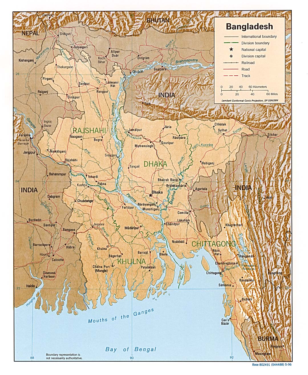
Bangladesh (Shaded Relief) 1996 (Map or infographic, English)
01449ban.pdf associated with Political map with water bodies and main cities
General maps (Map or infographic, English)
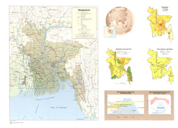
Thematic map on infrastructure (road; railway; airports; ports) with water bodies and main cities
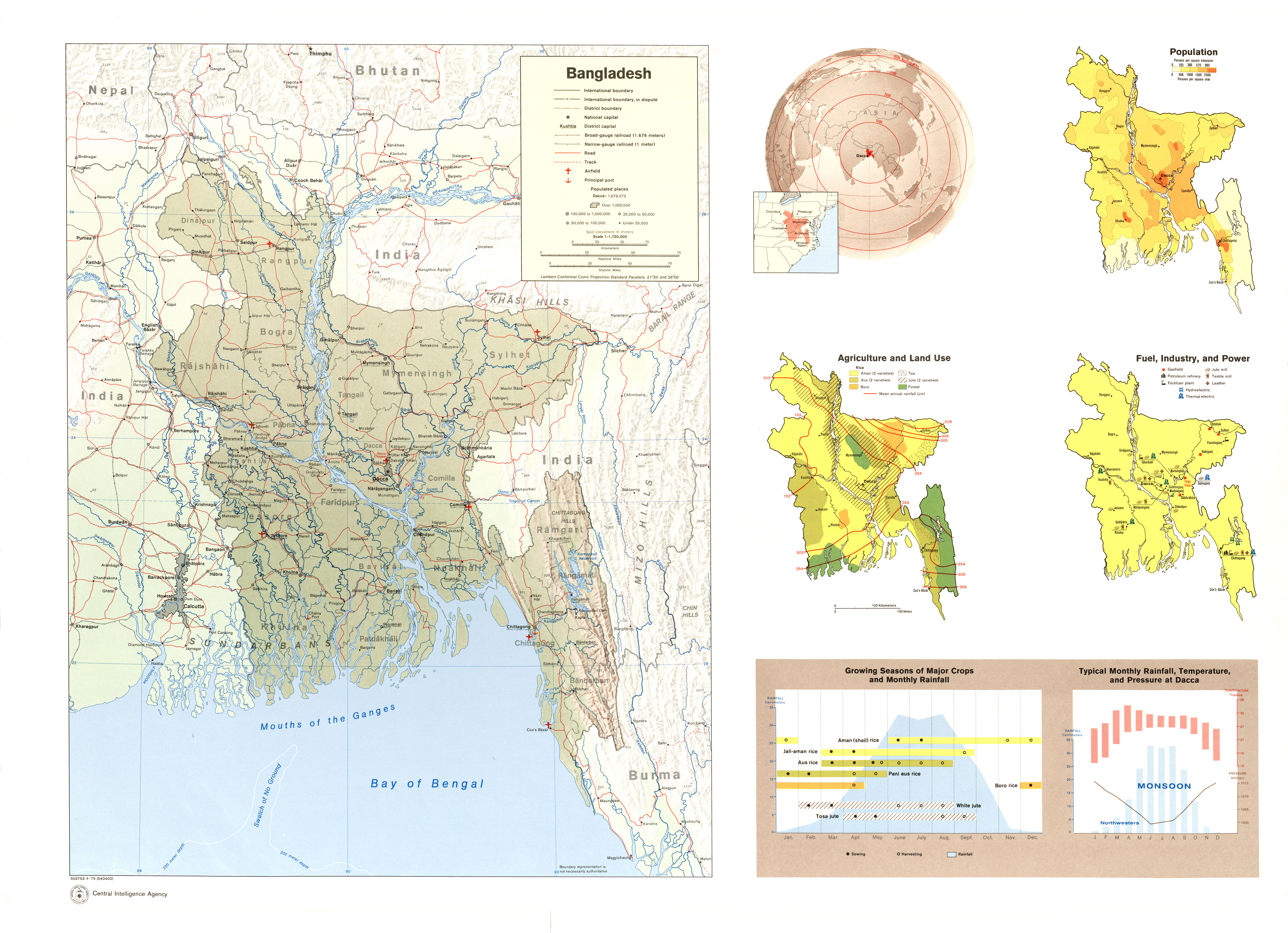
Bangladesh (Shaded Relief; Location; Population; Agriculture and Land Use; Fuel, Industry and Power; Growing Seasons of Major Crops and Monthly Rainfall (Chart); Typical Monthly Rainfall, Temperature and Pressure at Dacca (Chart)) 1979 (Map or infographic, English)
Documents found: 67
