Maps
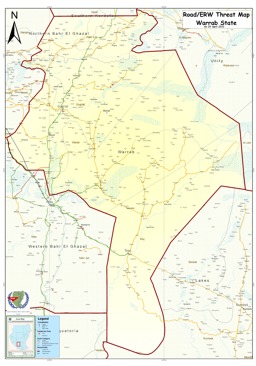
Warrab State: Road and landmine threat map
Road & Landmine / ERW Threat Map - Warrab State (Map or infographic, English)
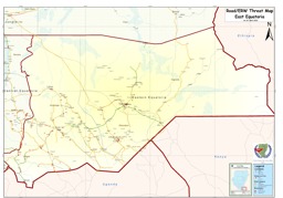
East Equatoria State: Road and landmine threat map
Road & Landmine / ERW Threat Map - East Equatoria (Map or infographic, English)
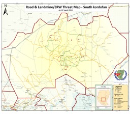
South Kordofan State: Road and landmine threat map
Road & Landmine / ERW Threat Map - South Kordofan (Map or infographic, English)
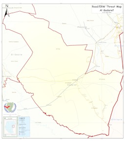
Al Gadaref State: Road and landmine threat map
Road & Landmine / ERW Threat Map - Al Gadaref (Map or infographic, English)
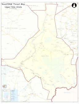
Upper Nile State: Road and landmine threat map
Road & Landmine / ERW Threat Map - Upper Nile State (Map or infographic, English)
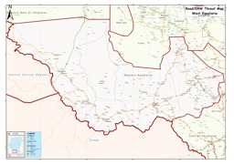
West Equatoria State: Road and landmine threat map
Road & Landmine / ERW Threat Map - West Equatoria (Map or infographic, English)
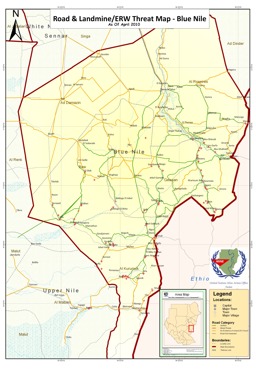
Blue Nile State: Road and landmine threat map
Road & Landmine / ERW Threat Map - Blue Nile (Map or infographic, English)
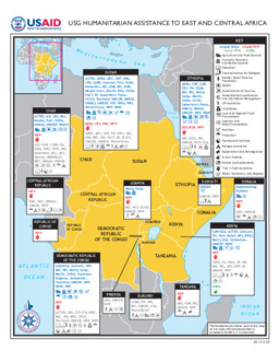
Situation map on humanitarian assistance by USAID (as of 11 January 2010)
USG Humanitarian Assistance to East and Central Africa (Map or infographic, English)
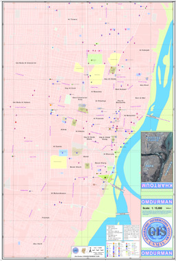
Map of Omdurman
Geographic Information System – Map 1221 (Map or infographic, English)
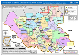
Southern Sudan: Map on distribution of ethnic groups (as of 24 Dec 2009)
Distribution of Ethnic Groups in Southern Sudan (as of 24 Dec 2009) (Map or infographic, English)


Documents found: 704
