Maps
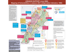
Infographic on vulnerability in Lebanon (as of June 2008)
Lebanon Support (June 2008) Mapping of Vulnerabilities in Lebanon (SE-1) (Deprivation Indicators, 1996) (Map or infographic, English)
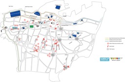
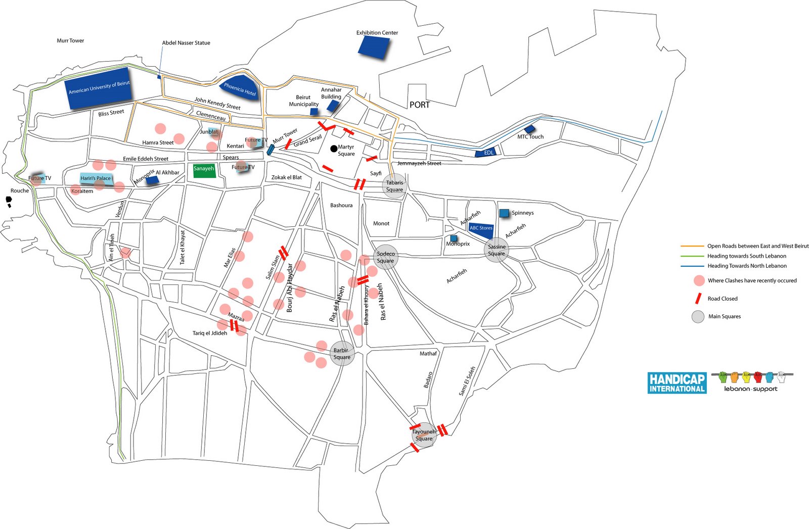
Beirut: Situation map on roads and the locations of clashes (as of 14 May 2008)
Beirut Movement Map (14 May 2008) (Map or infographic, English)
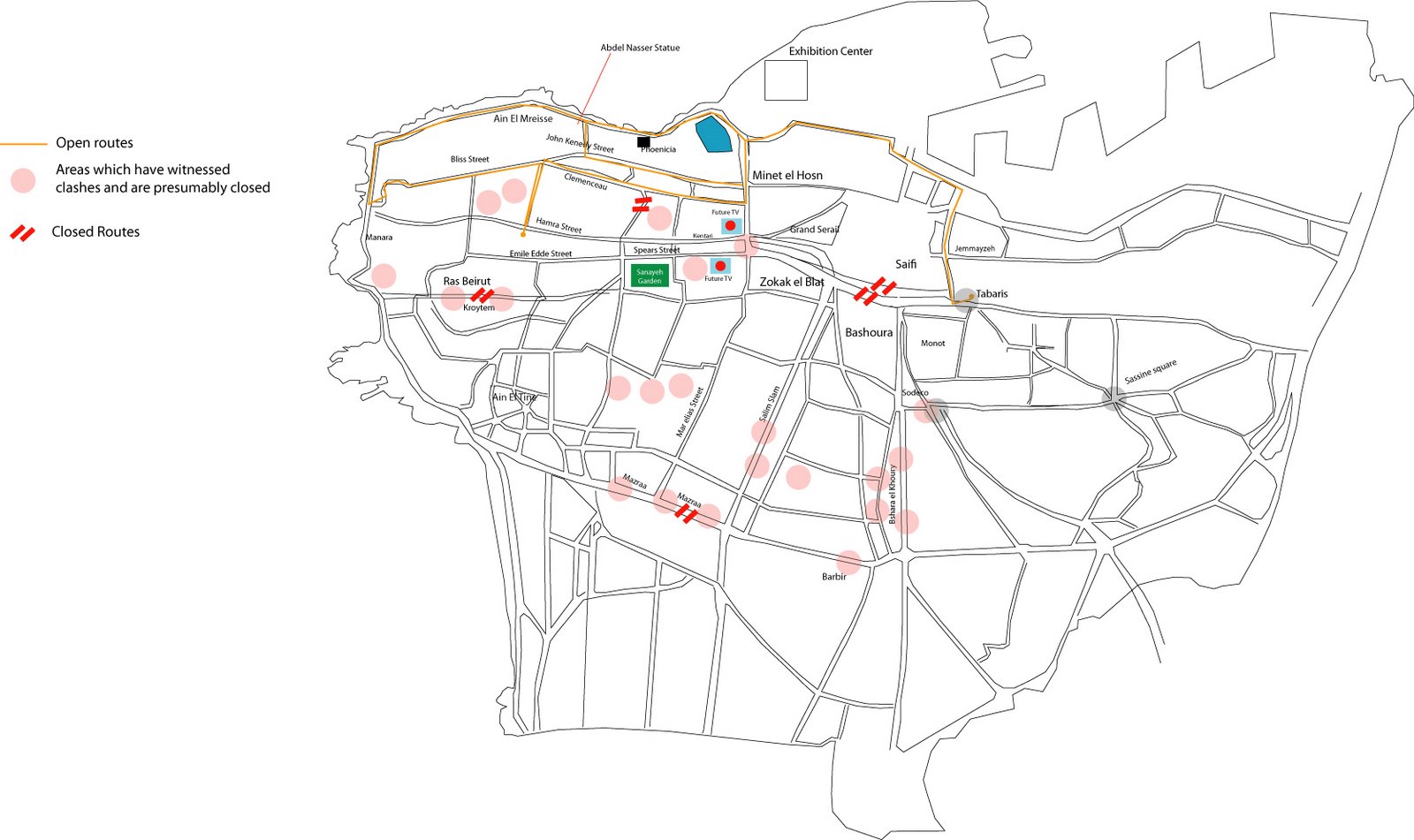
Beirut: Situation map on roads and locations of clashes (as of 14 May 2008)
Beirut Movement Map 2 (14 May 2008) (Map or infographic, English)

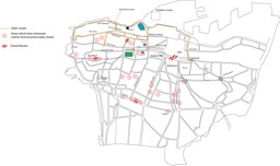
Greater Beirut: Situation map of locations of clashes (as of 11 May 2008)
Map of locations of clashes in arounf Beirut, 11 May 2008 (Map or infographic, English)
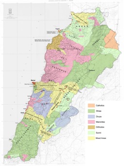
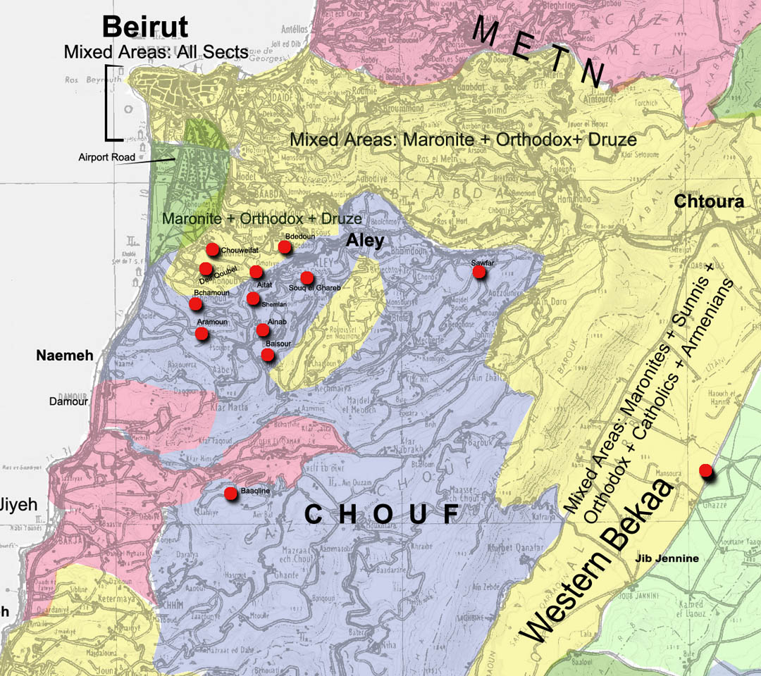
Population map on the distribution of religious groups and locations of clashes (as of 10 May 2008)
Map of locations of clashes, 10 May 2008 (Map or infographic, English)

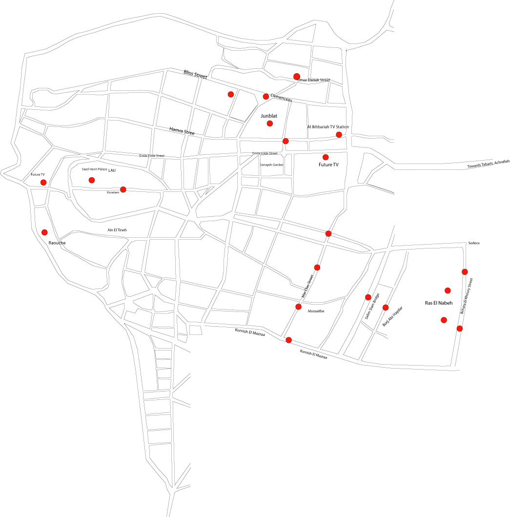
Beirut: Situation map on locations of clashes (as of 9 May 2008)
Map of locations of clashes in Beirut, 9 May 2008 (Map or infographic, English)
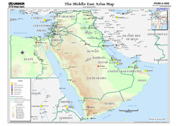
Middle East: Situation map on infrastructure (UNHCR offices; refugee settlements; IDP settlements) (as of January 2007)
The Middle East: Atlas map (as of January 2007) (Map or infographic, English)
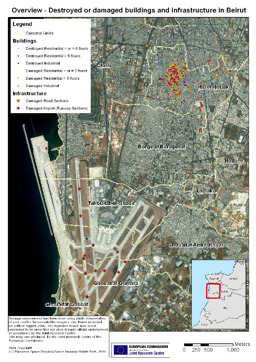
Beirut: Situation map of destroyed or damaged buildings and infrastructure
Overview - destoryed or damaged buildings and infrastructure in Beirut (Map or infographic, English)
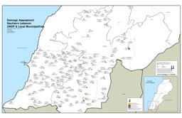
South Lebanon: Situation map on damage assessment
Damage assessment Southern Lebanon - UNDP & local municipalities (Map or infographic, English)
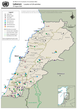
Situation map of locations of UN activities (as of 27 August 2006)
Location of UN activities (as of 27 Aug 2006) (Map or infographic, English)

Documents found: 244
