Maps
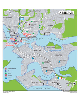
Abidjan: City map
Reference map of Abidjan, Côte d'Ivoire (Map or infographic, English)
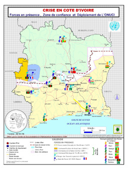
Situation map on presence of forces, confidence zone and deployment of UN Peacekeeping Force (as of 20 October 2004)
Côte d'Ivoire: Force en présence, zone de confiance et déploiement de l'ONUCI (20 OCt 2004) (OCHA) (Map or infographic, English)
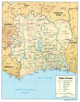
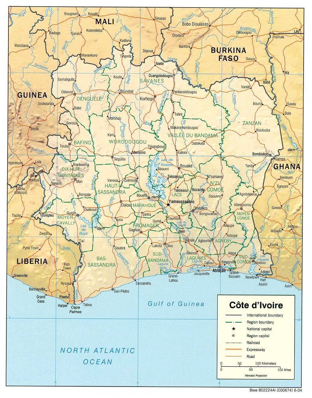
Thematic map on infrastructure (roads; railway), with water bodies, main cities and administrative divisions (district level)
Cote d'Ivoire (Reference Map) 2004 (Map or infographic, English)
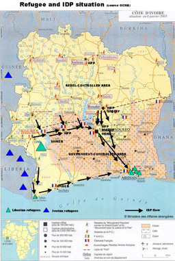
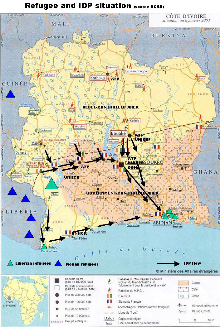
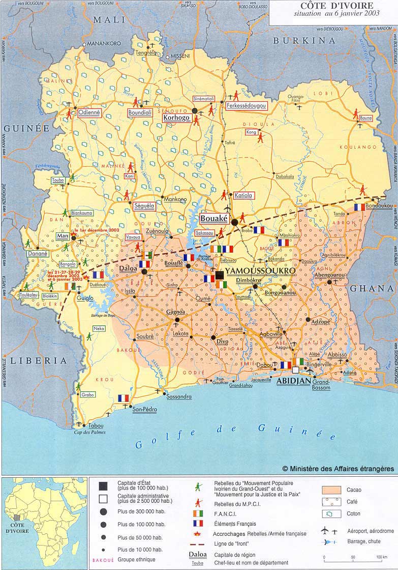
Situation map on displacement (distribution of refugees; distribution of IDPs) (as of 6 January 2003)
Cote d Ivoire: refugee and IDP situation (source OCHA) (Map or infographic, English)
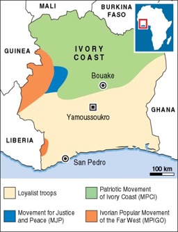
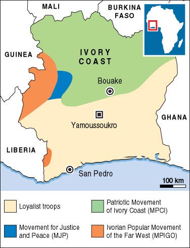
Situation map of lines of control of government and rebel troops
Ivory Coast: who controls what (Alertnet) (Map or infographic, English)
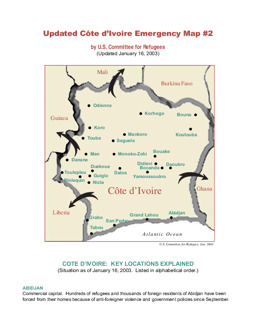
02425ic.pdf associated with Situation map on the emergency situation
Cote d'Ivoire Emergency Map #2 (Map or infographic, English)
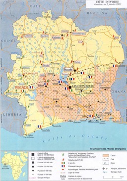
Situation map on displacement (distribution of refugees; distribution of IDPs) (as of 6 January 2003)
Cote d'Ivoire situation map (Government of France) (Map or infographic, English)
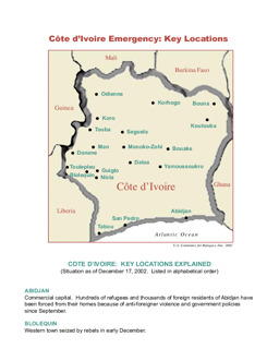
02409ic.pdf associated with Situation map on the emergency situation
Côte d ’Ivoire Emergency:Key Locations (Map or infographic, English)
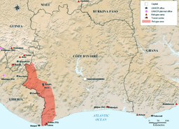
Situation map on displacement (distribution of refugee camps, transit centres and UNHCR offices)
Global Appeal 2003 - UNHCR in Côte d'Ivoire (Map or infographic, English)
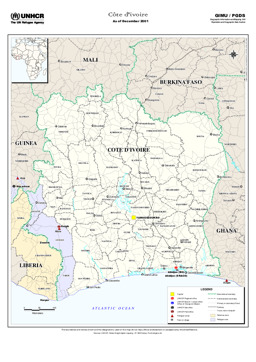
02238ic.pdf associated with Situation map on displacement (distribution of refugee camps and UNHCR offices), with main cities and administrative divisions (district level and regional level)
Côte d'ivoire (Map or infographic, English)
Documents found: 152
