Maps
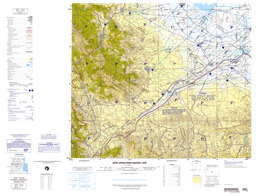
Topographic map with administrative divisions (province level) and infrastructure
NJ 38-3 Naxcivan, Azerbaijan; Armenia; Iran (Map or infographic, English)
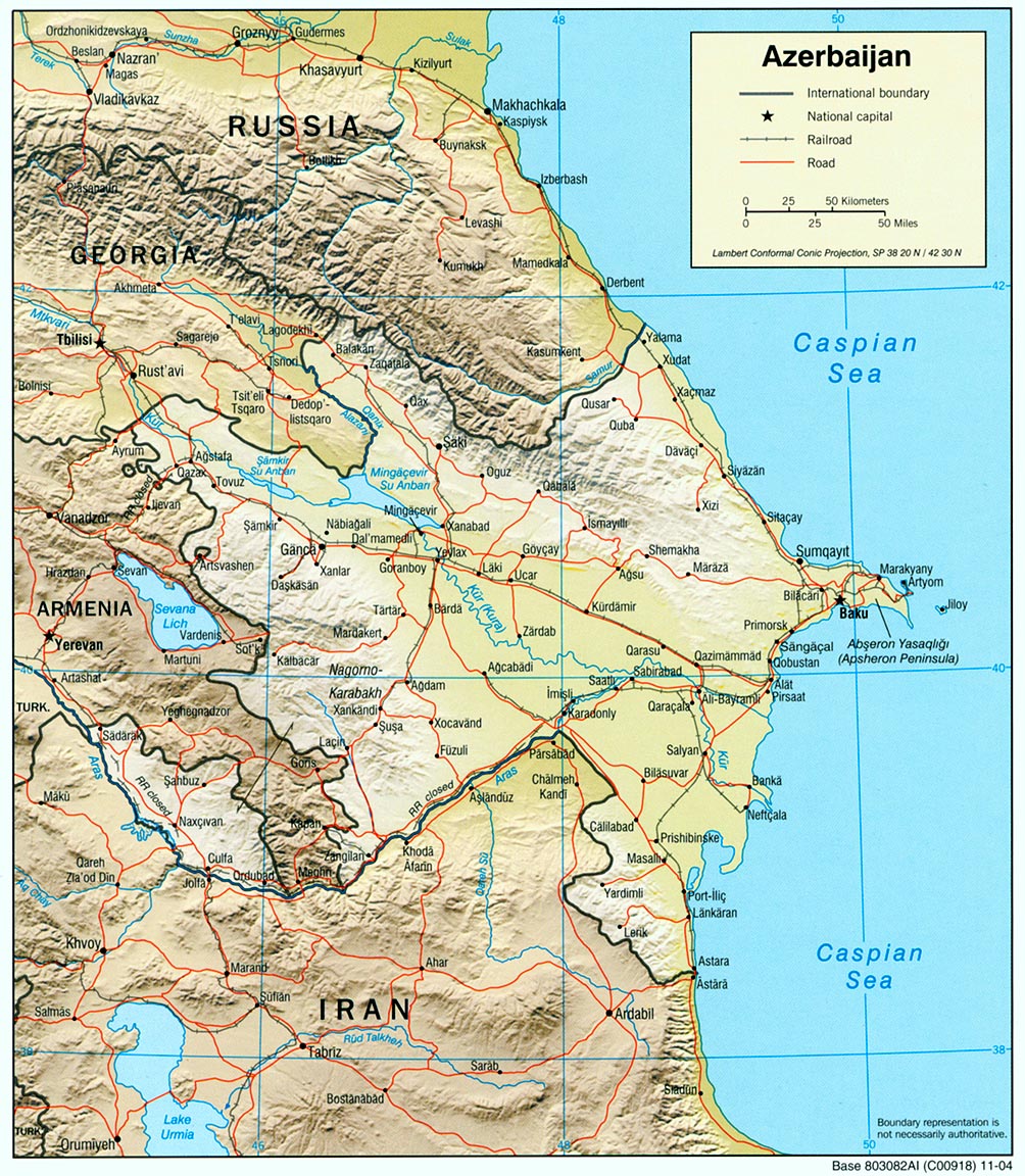
Thematic map on infrastructure with water bodies and main cities
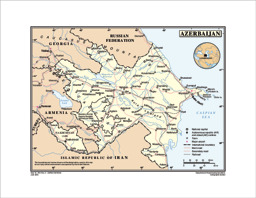
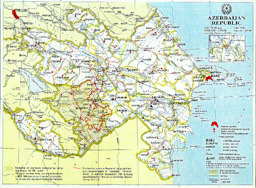
Reference Map of Azerbaijan (UN Cartographic Section) (Map or infographic, English)
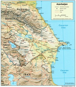
Thematic map on infrastructure (roads; railway) with water bodies and main cities
Azerbaijan (Shaded Relief) 2004 (Map or infographic, English)
Thematic map on infrastructure (road; railway) with water bodies and main cities
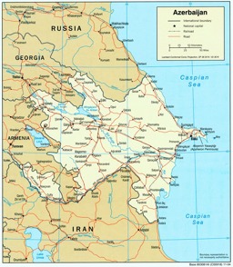
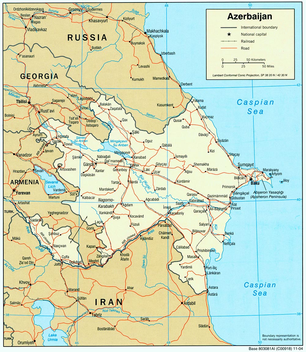
Azerbaijan (Political) 2004 (Map or infographic, English)
Thematic map on infrastructure (roads; railway) with water bodies and main cities
Map of Azerbaijan (UNDP) (Map or infographic, English)
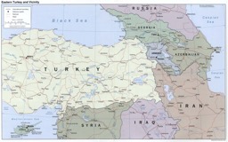
Thematic map on infrastructure (roads; railway) with water bodies and main cities in eastern Turkey and neighbouring states
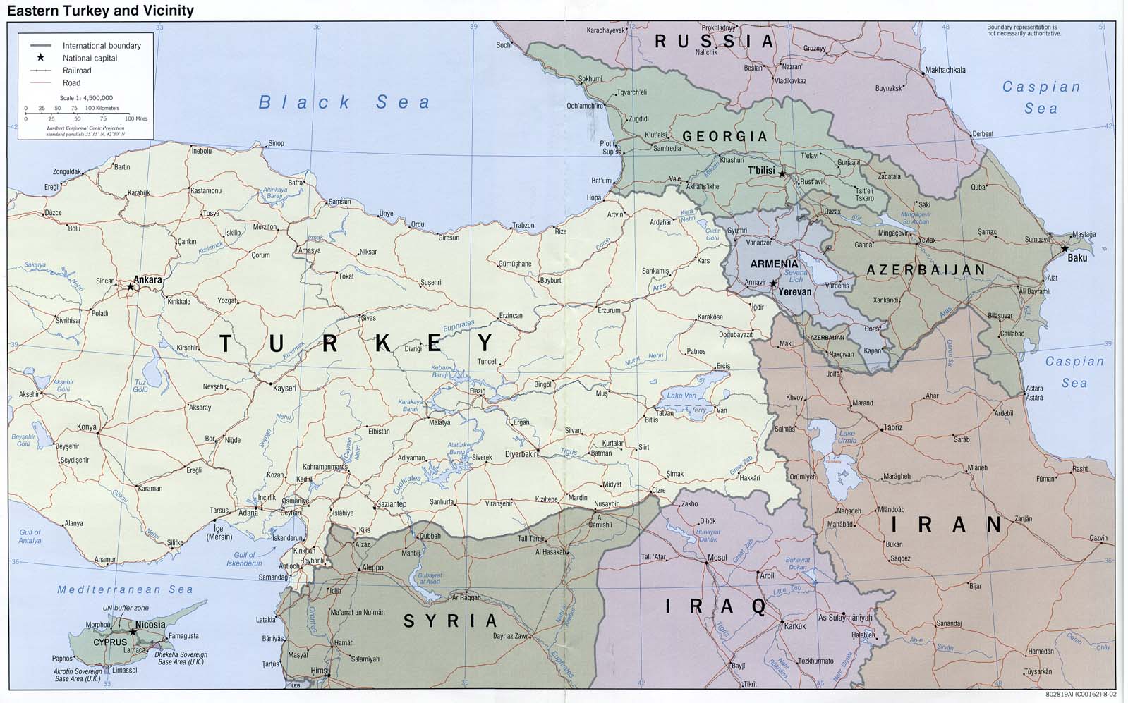
Eastern Turkey and Vicinity (Map or infographic, English)
Thematic map on infrastructure (roads; railway) with water bodies and main cities in Eastern Turkey and vicinity
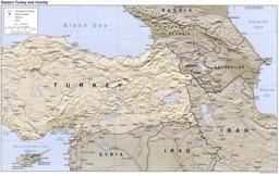
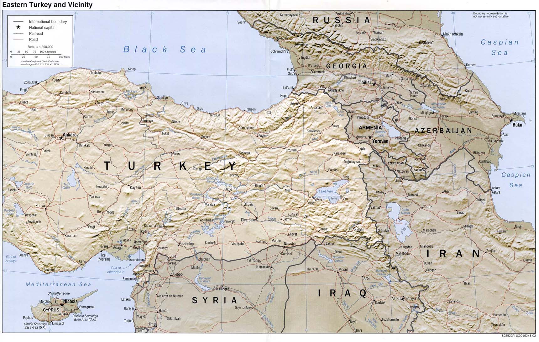
Eastern Turkey and Vicinity (Shaded Relief) 2002 (Map or infographic, English)
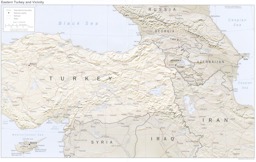
Thematic map on infrastructure (roads; railway) with water bodies and main cities in eastern Turkey and neighbouring states
Eastern Turkey and Vicinity (Map or infographic, English)
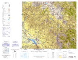
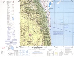
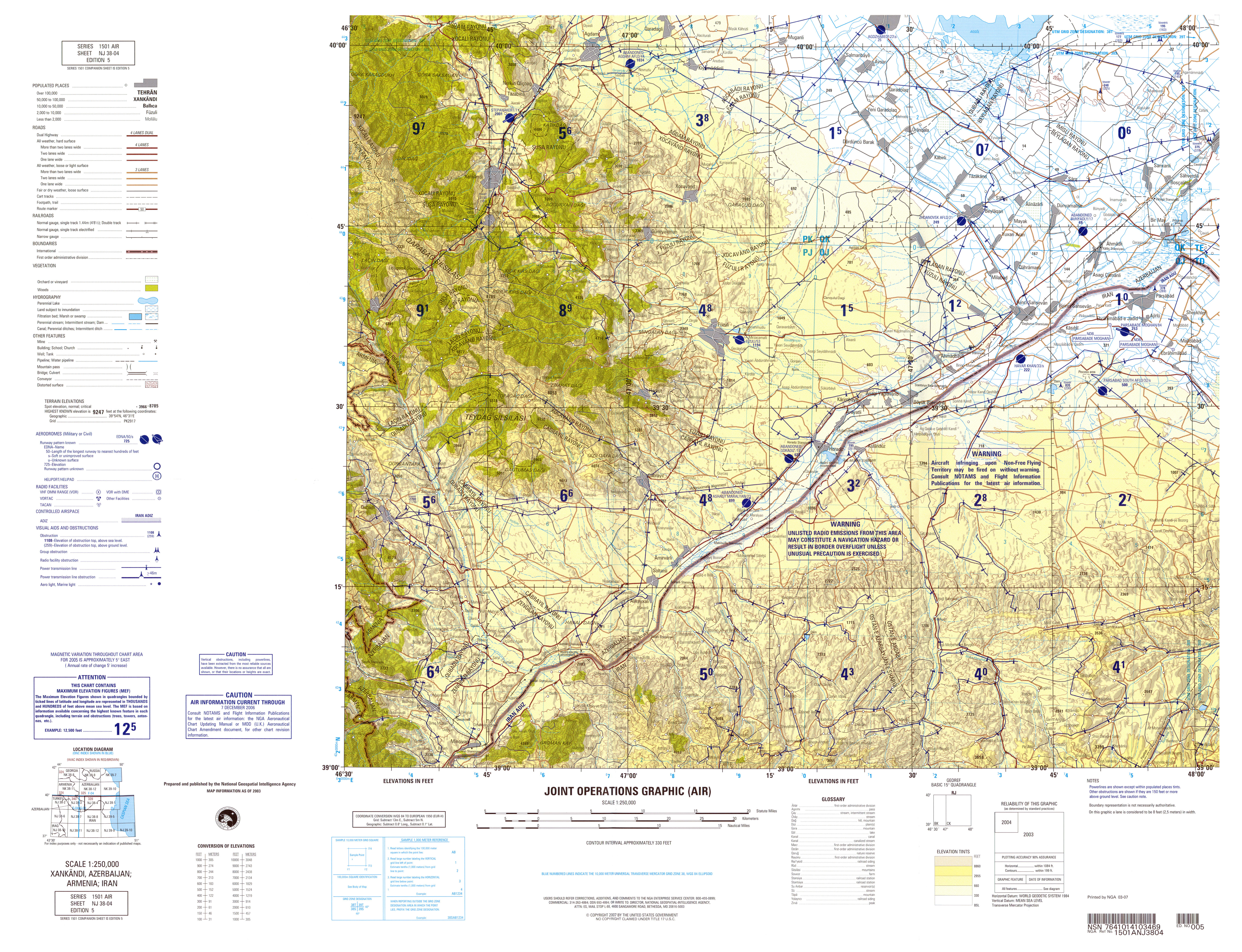
Xankendi region and border area with Iran: Topographical map on infrastructure and population centers
NJ 38-4 Xankandi, Azerbaijan; Iran (Map or infographic, English)
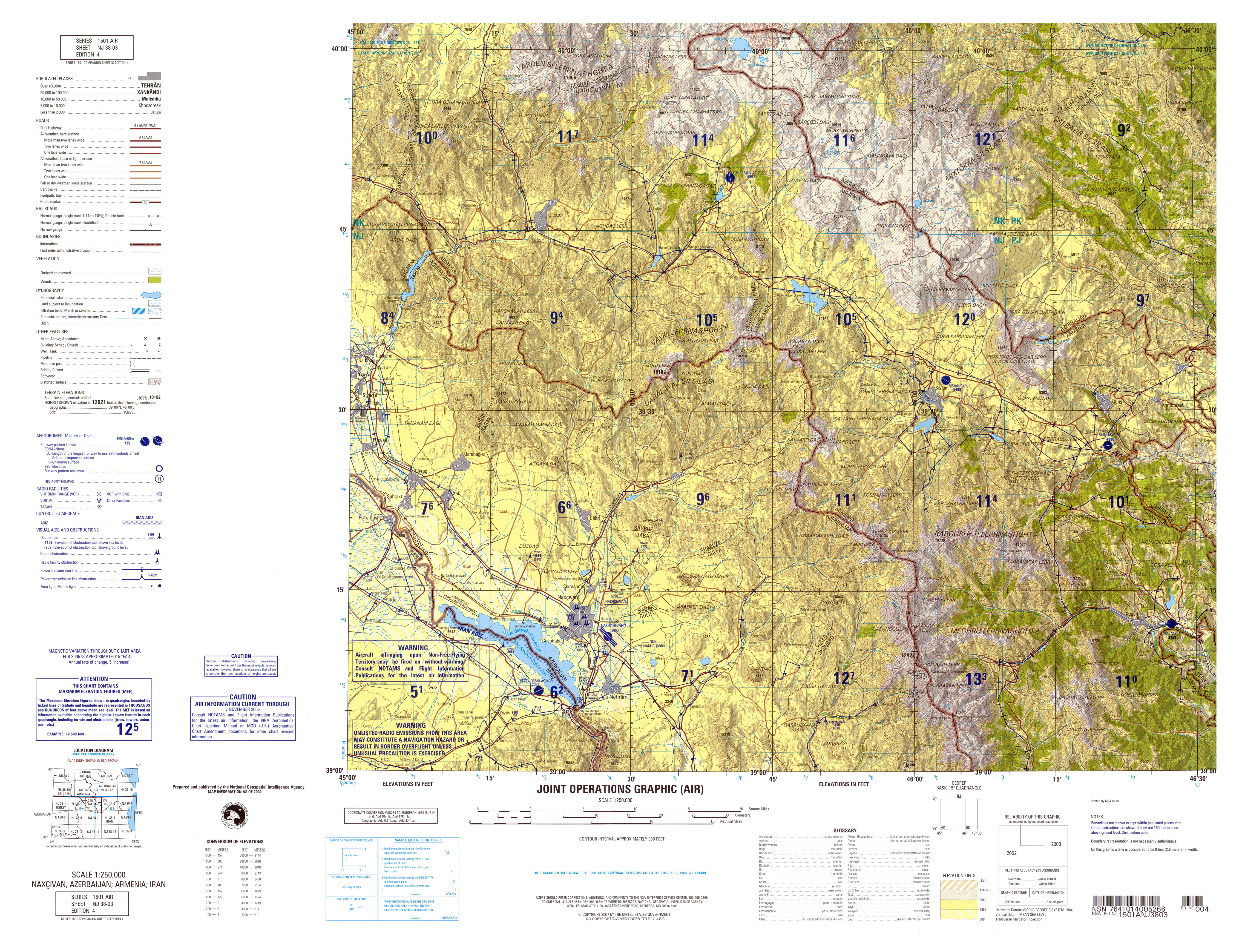
Ardabil province: Topographic map with administrative divisions (province level) and infrastructure
NJ 39-5 Ardabal, Iran; Azerbaijan (Map or infographic, English)


Documents found: 47
