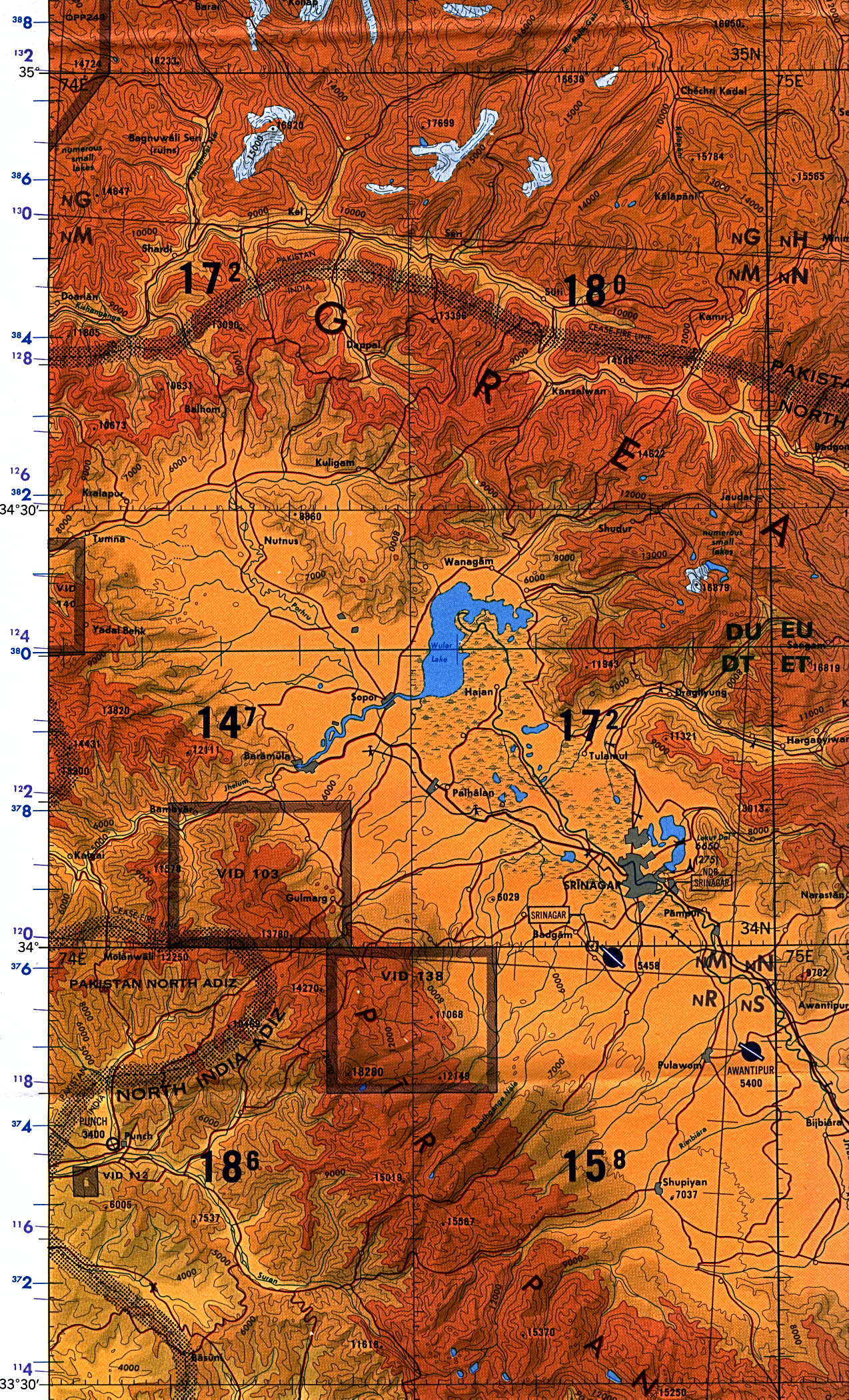
Srinagar Border Region Original scale 1:500,000 Portion of Tactical Pilotage Chart TPC G-7D, U.S. Defense Mapping Agency, 1995
Document #1026388
U.S. Defense Mapping Agency (Author), published by University of Texas Libraries
ecoi.net is run by the Austrian Red Cross (department ACCORD) in cooperation with Informationsverbund Asyl & Migration. ecoi.net is funded by the Asylum, Migration and Integration Fund, the Austrian Ministry of the Interior and Caritas Austria. ecoi.net is supported by ECRE & UNHCR.
