Maps

Map of Israel
Map of Israel (Map or infographic, English)

Map on Jewish settlements in the West Bank
Jewish Settlements in the West Bank (Map or infographic, English)

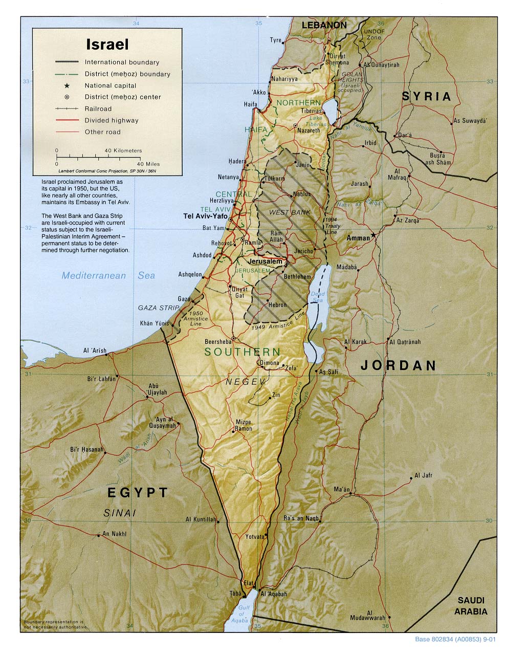
Political map
Israel (Shaded Relief) 2001 (Map or infographic, English)

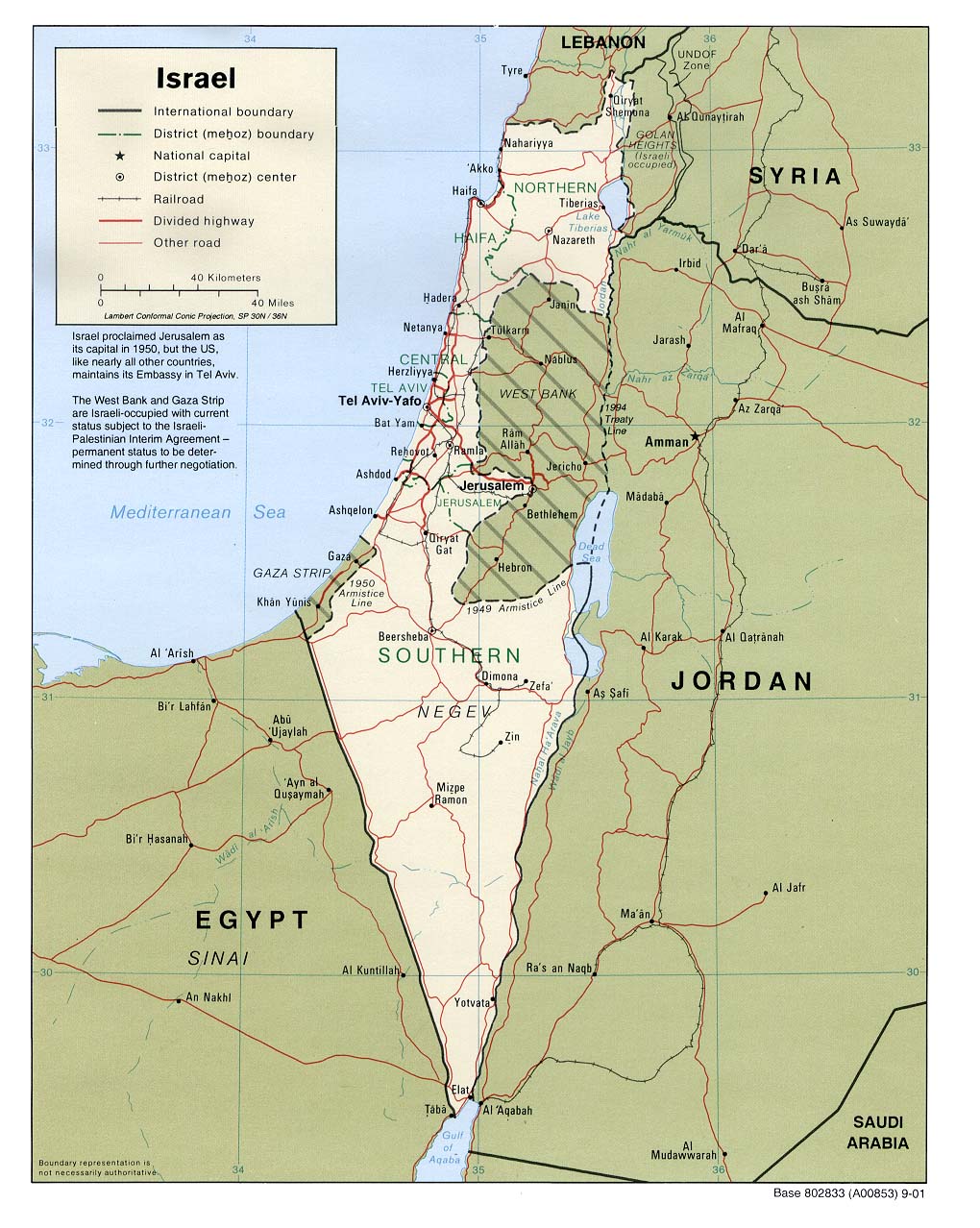
Political map
Israel (Political) 2001 (Map or infographic, English)

01442isra.pdf associated with General maps
General maps (Map or infographic, English)

Map on administrative divisions
Israel - Administrative Divisions from Atlas of the Middle East (Map or infographic, English)

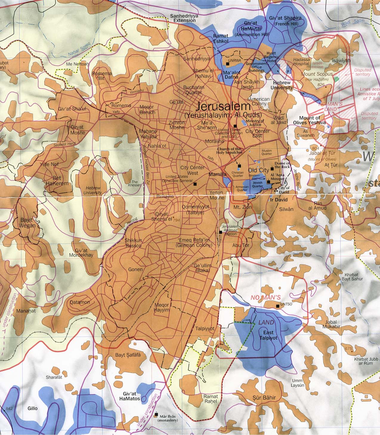
Political map of Jerusalem
Jerusalem part of "Jerusalem and Vicinity" March 1993 original scale 1:35,000 (Map or infographic, English)

Political map of Jerusalem-Jericho Area
Jerusalem-Jericho Area original scale 1:150,000 1992 (Map or infographic, English)

Situation map with major cities on Israeli settlements in the Golan Heights
Israeli Settlements in the Golan Heights 1992 (Map or infographic, English)

Situation map with major cities and infrastructure (roads; railway) on Israeli settlements in the Golan Heights
Israeli Settlements in the Golan Heights (Shaded Relief) 1989 (Map or infographic, English)


Documents found: 21
